COP26 march Glasgow: Route, road closures and start time of Saturday's huge climate COP26 protest in Glasgow
As Greta Thunberg and young climate activists from all over the world march through Glasgow on Friday 5 November for the Fridays for Future climate protest, an even larger COP26 march is expected in Glasgow on Saturday 6 November.
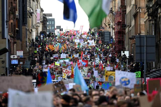
To mark the Global Day of Action for the Climate, an annual day of awareness and protest to highlight the dangers of climate change and inaction on it, tens of thousands of protestors from nations worldwide will take part in a huge Glasgow march through the city centre.

Advertisement
Hide AdAdvertisement
Hide AdThe COP26 march in Glasgow will see roads across the city shut to accommodate the route of the protest.
Here’s everything you need to know about Saturday’s climate march in Glasgow, including the route protestors will take, what time it will start and which roads will be closed.
What is the route of Saturday’s COP26 march in Glasgow?
The Global Day of Climate Action march through Glasgow will begin at Kelvingrove Park in the west end of the city.
Protestors will then proceed out of the park in the heart of the west end and onto Kelvin Way, before turning right onto Sauchiehall Street, then down Kelvingrove Street to continue along Argyle Street.
At the intersection of Argyle Street with Breadalbane Street, St Vincent Street and Elliot Street, the protest will change to move along St Vincent Street and continuing along this over the M8 and into the city centre.
As the protest moves into the city centre, it will make a left onto Pitt Street and then continue along West George Street and on George Street after passing George Square.
It will then turn down High Street and travel down the length of this and Saltmarket until reaching Glasgow Green – where the protest will come to an end.
What time will the Glasgow climate march start?
The Glasgow climate march during COP26 on Saturday is set to officially kick off at 12pm on Saturday.
Advertisement
Hide AdAdvertisement
Hide AdUp to 100,000 expected participants are set to gather in Kelvingrove Park from 11am onwards at the Stewart Memorial Fountain before marching through the city centre to Glasgow Green.
Which Glasgow roads will be closed for the COP26 protest?
According to Get Ready Glasgow, Glasgow City Council’s online transport information website, from 5am on Saturday 6 November until 6pm the following roads will be closed to all vehicles, except pedal bikes, with no access from any direction:
Anchor Lane for its full length
Argyle Street between Kelvingrove Street and St Vincent Street
Blythswood Square (south side) for its full length
Blythswood Square between West Regent Street and West George Street
Bridgegate between King Street and Saltmarket
Crown Street for its full length
Douglas Street St Vincent Street and West George Street
Duke Street between High Street and John Knox Street
Dumbarton Road between Byres Road and Argyle Street (eastbound closed only)
Elmbank Street between Elmbank Crescent and St Vincent Street
George Square (north side) for its full length
George Street between George Square and High Street
Greendyke Street between London Road and Charlotte Street
Greendyke Street between Turnbull Street and Saltmarket
High Street for its full length
Holland Street between West George Street and St Vincent Street
Hope Street between St Vincent Street and West George Street
Advertisement
Hide AdAdvertisement
Hide AdKelvingrove Street between Sauchiehall Street and Argyle Street
London Road between James Morrison Street and Saltmarket
Nelson Mandela Place for its full length
Newton Street between Elmbank Crescent and St Vincent Street
North Hanover Street between Cathedral Street and George Square
Pitt Street between St Vincent Street and West George Street
Radnor Street between Sauchiehall Street and Argyle Street
Renfield Street between West Regent Street and West George Street
Sauchiehall Street between Argyle Street and Royal Crescent
Shuttle Street for its full length
South Frederick Street, northbound only
St Vincent Street between Argyle Street and Pitt Street
Trongate between Albion Street and Gallowgate
Wellington Street between West Regent Street and West George Street
West Campbell Street between St Vincent Street and West George Street
West George Street between Pitt Street and George Square
West Nile Street between St Vincent Street and Bath Street.