RECAP Storm Ciarán: Disruption continues across Scotland's railway line following signal outage

Network Rail working to fix major signal outage in Edinburgh areaNetwork Rail working to fix major signal outage in Edinburgh area
Network Rail working to fix major signal outage in Edinburgh area | Network Rail
A yellow rain warning is in place for Scotland's east coast today.

Travel disruption continues at Scotland's railway due to a major signal outage on Thursday afternoon in the Edinburgh area which left hundreds of passengers stranded for hours. Follow here for more updates on travel and weather today.

RECAP Storm Ciarán: Disruption continues across Scotland's railway line following signal outage

Key Events

  • Travel delays and disruption continue across Scotland's railway after major signal fault
  • Met Office yellow weather warning for rain in place for north east
  • LNER strongly advises passengers against travel on Friday following major signal outage

A 24-hour yellow weather warning for rain is in place for the east cost of Scotland and parts of England.

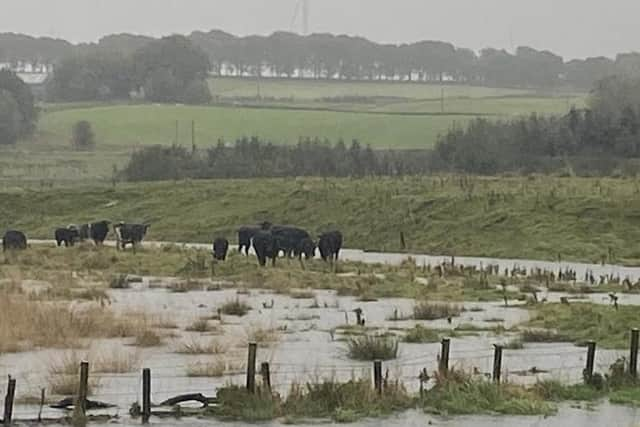
The areas affected are likely to experience disruption to travel and flooding.

The Scottish Environment Protection Agency has issued 12 flood alerts across parts of Scotland and two flood warnings  in Dumfries and Galloway and Tayside. The weather warnings come after communities on Scotland's east coast, including in Aberdeenshire and Angus, were left devastated by flooding caused by storm Babet.

Walker makes lucky escape after sea wall walkway collapses under his feet

The stormy weather has brought with it rough sea conditions which are causing serious damage along Scotland's east coast.

A man made a narrow escape in Pittenweem in Fife after the sea wall walkway caved beneath him.

Read the story here written by our environment correspondent Ilona Amos:

A Pittenweem man has had a lucky escape after a seafront walkway in the picturesque coastal village disintegrated beneath his feet following wild weather and exceptionally high tides last weekend, plunging him into a giant hole which had opened up.

A Pittenweem man has had a lucky escape after a seafront walkway in the picturesque coastal village disintegrated beneath his feet following wild weather and exceptionally high tides last weekend, plunging him into a giant hole which had opened up.
A Pittenweem man has had a lucky escape after a seafront walkway in the picturesque coastal village disintegrated beneath his feet following wild weather and exceptionally high tides last weekend, plunging him into a giant hole which had opened up. | Supplied

Statement from the Met Office

"Periods of heavy rain associated with Storm Ciaran will affect parts of northeast England and eastern Scotland during Thursday and early Friday.

"Rainfall amounts are likely to reach 20-30 mm widely, with 40-60 mm accumulating over high ground, including the Cheviots, North Pennines and North York Moors. Strong easterly winds, becoming northerly by Friday morning, will accompany the rainfall, possibly exacerbating any impacts."

Parts of Fife Coastal Path washed away

Several sections of the Fife Coastal Path have been washed away in the latest bout of stormy weather.

A spokeswoman from Fife Countryside Trust, which looks after the path, said the most significant damage has occurred along the coastline between Kirkcaldy to North East Fife.  

Here are the areas the key sites where the effects of Storm Babet and recent storm surges and high tides were felt:

  • A high tide diversion with diversions in place between East and West Wemyss as a section of the Fife Coastal Path was washed away.  

  • Between Elie Ruby Bay and St Monans, a section of the path wash washed away – diversion now in place. 

  • Pathhead Sands has seen severe damage. Pathhead Sands is currently closed to allow heavy machinery to reinforce the shoreline, rebuild fencing and to clear car parks, which were left with several hundred tonnes of silt covering them.  

  • Access points to Seafield Beach have been damage by high tide, while a section of path has been eroded.  

  • The coastal defences at Leven Prom were also damaged by storm surges. 

  • The Fife Coastal Path has been damaged at St Andrews Harbour. 

St Andrews Harbour and main pier closed until further notice

Earlier this week, the harbour and main pier in St Andrews were closed to members of the public for safety reasons after the coastal structures suffered damage during Storm Babet

Read more here:

St Andrews Harbour, pier and slipways have all been seriously damaged in the latest bout of stormy weather St Andrews Harbour, pier and slipways have all been seriously damaged in the latest bout of stormy weather
St Andrews Harbour, pier and slipways have all been seriously damaged in the latest bout of stormy weather | St Andrews Harbour Trust

Delays to travel expected with speed restrictions on main train routes due to weather

ScotRail said customers travelling between the Central Belt and Aberdeen on Friday, 3 November, will need to change at Dundee as there will be no direct ScotRail services between Glasgow and Aberdeen, and between Edinburgh Waverley and Aberdeen, from the start of service until mid-afternoon.

The train operator said the speed restrictions will cause delays along the impacted routes. Passengers have been urged to check journey times before travelling.

Storm Ciarán to impact LNER services between Aberdeen, Edinburgh and Newcastle

  • Services between Edinburgh and Aberdeen: There will be no LNER train services operating from Edinburgh to Aberdeen, in both directions until Saturday.
  • Services between Newcastle and Edinburgh: From 3pm on Thursday, an hourly train service will be running between Edinburgh and Newcastle, in both directions. This will be in place until the end of service on Friday. These train services will be subject to delays of up to 40 minutes due to a speed restriction in place on this route.
  • Services between Edinburgh and Inverness are planned to run throughout this period.

Major incident declared in England with almost 280 flood warnings and alerts in place

South of the border has been particularly hit by the latest named storm.

Here are some of the latest updates in England:

  • Thousands of homes have been left without power, including 9,000 across Devon and Cornwall and more than 6,500 in Surrey.
  • The port of Dover had to suspend all sailings earlier because of the weather, but it has now reopened for shipping vessels. There may, however, still be delays over the next few hours due to traffic clearing. Passenger ferries also remain cancelled.
  • At the time of writing, the Environment Agency has in place 82 flood warnings in England, meaning flooding is expected. There are also 197 flood alerts, meaning flooding is possible. Most of the flood warnings are clustered around the south coast of England, but there are some in Stroud, Dauntsey near Chippenham, villages on the River Bure, Ant and Thurne in Norfolk, and as far north as Sunderland.

PA

Mountain weather group shares dramatic satellite images of Storm Ciaran

SEPA updates flood warning list

Some flood warnings and alerts issued by the Scottish Environment Protection Agency have now been removed.

There are still flood alerts in place for:

  • Aberdeenshire and Aberdeen City
  • Dundee and Angus
  • Edinburgh and Lothians
  • Fife
  • Findhorn Nairn Moray and Speyside
  • Scottish Borders

Storm Babet and Storm Ciaran have caused significant flooding in areas along Scotland's east coast Storm Babet and Storm Ciaran have caused significant flooding in areas along Scotland's east coast
Storm Babet and Storm Ciaran have caused significant flooding in areas along Scotland's east coast | RSABI

What weather warnings are still in place?

Rain

  • A yellow warning in north-east England and eastern Scotland is in place until 06:00 tomorrow. The Met Office says there is a small chance homes and businesses could be flooded.
  • Two yellow warnings for London and parts of south-east England, south-west England and Wales until midnight tonight. There is a small chance of flooding here too.

Wind

  • A yellow warning in London and parts of southern and eastern England until 17:00 today. The Met Office said damage to buildings and injuries from flying debris were possible.
  • Outside of the warnings for the UK, a red warning - the highest level - has also been issued by the Jersey Met for today.

Annual fireworks display cancelled due to weather

Hopetoun House fireworks and bonfire night has been cancelled.

The event was due to take place in the grounds of the country house near South Queensferry on Saturday.

A statement from organisers released on social media read: "Due to unexpected circumstances beyond our control - storm Ciaran and the associated significant rainfall - the estate grounds at Hopetoun are not in a viable condition to host large gatherings of people.

"Sadly, that means that we are not able to proceed with our annual Hopetoun ireworks and bonfire night this Saturday 4th November.

"We understand that this will be very disappointing news, however, we have worked hard to deliver alternative options for you and will be in touch directly via the ticketing platform to update you on these options. Thank you for your support and understanding."

Scotland's west coast enjoys sunshine while the east still feels the impact of Storm Ciaran

Here is one of the latest photos of the current storm from space shared by the Met Office:

What are the Storm names for 2023/24?

As Scotland battens down the hatches for more stormy weather we look at the other names that will be bringing wind, rain and snow in the months to come.

Read this story to see the 21 names chosen this year - including Hamish and Stuart:

Storm Babet has brought high winds and heavy rain to areas across the UK, but the Met Office has given an update one when the bad weather could end. (Credit: Owen Humphreys/PA WireStorm Babet has brought high winds and heavy rain to areas across the UK, but the Met Office has given an update one when the bad weather could end. (Credit: Owen Humphreys/PA Wire
Storm Babet has brought high winds and heavy rain to areas across the UK, but the Met Office has given an update one when the bad weather could end. (Credit: Owen Humphreys/PA Wire | Owen Humphreys/PA Wire

Teams from Scotland called to assist power outages south of the border as thousands remain without power

Nearly 20,000 homes across the UK are without power.

Emergency teams from Scotland and Isle of Man have been called to strategic locations in the south of England to assist.

The Energy Networks Association (ENA) - which represents energy companies - says 107,000 properties had power restored "in very challenging conditions" - and as of midday, 19,800 customers were still without power.

Loganair flights to Edinburgh have been cancelled

Flights with airline Loganair have been heavily disrupted due to Storm Ciaran.

Flights due to leave this afternoon from Newquay, Southampton and Sumburgh to Edinburgh have all been cancelled.

There have also been delays to flights from Aberdeen and Bergen.

Loganair said due to the yellow and amber weather warning in place in parts of the UK, it is offering customers affected the option to change their travel date without charge up to seven days of original date.

Flight departures and arrivals for Loganair can be checked here: https://www.loganair.co.uk/login/flight-status/

Storm Ciaran sets new pressure record

In general, low pressure leads to unsettled weather conditions and high pressure leads to settled weather conditions.

Pressure is measured in hectoPascals (hPa), also called millibars (mb). Standard pressure at sea level is defined as 1013hPa, but there can be large areas of either high or low pressure. 

England and Wales have had their lowest mean sea level pressure on record for November during Storm Ciaran, with a value of 953.3 hPa (mb) in Plymouth and 958.5 hPa (mb) in St Athan, the Met Office said.

It has been reported the previous record in England was 959.7 hPa (mb), set in 1916, and the previous record in Wales was 962.7 hPa (mb), set in 2010.

Updated yellow weather warning for Scotland

A yellow weather warning for rain covering mainly the Grampian and Highland areas has been extended.

The alert was initially in place until 6am on Friday but will now stretch to 6pm.

Parts of East Lothian, the Scottish Borders and Angus are also covered by the warning.

A statement from the Met Office read: "Periods of heavy rain associated with Storm Ciarán will affect parts of eastern Scotland during the rest of Thursday and Friday, before easing towards Friday evening; northern parts of the warning area will probably be slowest to improve. Rainfall amounts are likely to reach 20-30 mm quite widely, with 40-60 mm possible over high ground. Strong winds at times, perhaps exacerbating any impacts."

Reason for update

Parts of east and northeast England have now been removed from the warning. Adjustments have been made to the Scottish area, with the later end time, this applying chiefly to northern parts of the warning area.

The Met Office said the heavy rain associated with Storm Ciarán could bring some disruption:

  • Spray and flooding could lead to difficult driving conditions and some road closures
  • Where flooding occurs, there is a chance of delays or cancellations to train and bus services
  • There is a small chance that homes and businesses could be flooded, causing damage to some buildings
  • There is a small chance of fast flowing or deep floodwater

Comments

 0 comments

Want to join the conversation? Please or to comment on this article.

Dare to be Honest
Follow us
©National World Publishing Ltd. All rights reserved.Cookie SettingsTerms and ConditionsPrivacy notice