Scottish walks: Meall na Leitreach


Given the height of the A9, the ascent required is only some 400m and with a distance of just over 2 miles it is easy to see why the hill makes for a short but good winter outing, though arguably too easy for a summer’s day. On our late February day, it was a fourth Corbett (round) time for Rhona, a third time for me but a first visit for Jimbo and John. My first visit with Geraldine and Alex Joss was away back in January 1984 (no records were kept of the second visit), a cold windy day with wintry views for time to time.
Dalnaspidal lies at the southern end of the glacier-gouged narrow Pass of Drumochter, nowadays congested by three roads (the early 18th century General Wade’s Military Road, the old and new A9) as well as a main line railway and large electricity transmission pylons.
Advertisement
Hide AdAdvertisement
Hide AdExcluding the likes of Snowdon, Dalnaspidal was once the highest railway station in Britain. It closed to regular passenger traffic in 1965 and in the 1970s the wooden station building was taken down. However, the long platforms are still extant and are easily seen to the right from the descent road from the A9. Dalnaspidal, field of the hospice, refers to the one time hospice or inn.
Map Ordnance survey map 42, Glen Garry & Loch Rannoch
Distance 5 miles
Height 400m
Terrain Track to heathery slopes
Start point Dalnaspidal lay-by, north end of A9 dual carriageway
Time 3 hours
Nearest village Dalwhinnie
Refreshment spot House of Bruar, Blair Atholl
From the lay-by at the north end of the A9 dual carriageway, a Tarmac road then track leads to Dalnaspidal Lodge, part of Ben Alder Estate. The road crosses the old A9 then descends to a signpost, right of way, public path to Loch Rannoch, and the railway level crossing. Take note of the warning sign. Stop. Look. Listen.
Before the entrance to the Lodge, turn right as signposted Rannoch 10 miles and follow the broad track on an embankment that leads towards the north end of Loch Garry. (This continues as an old through route to Loch Rannoch and is shown on William Roy’s map of 1755. Roy was the chief surveyor of the Military Survey of Scotland 1747-1755 which had a seminal influence on the early work of the Ordnance Survey).
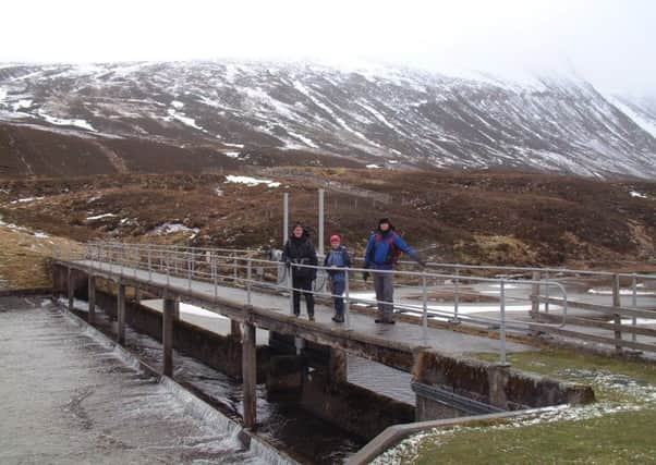
Water from Loch Garry is abstracted by tunnel, a drop of 56m, to Loch Ericht and so to Rannoch Power Station, and the water flow control works by the northern end of the loch give easy access by the wet area west of the lodge. Cross a concrete bridge over the Allt Dubhaig, then immediately turn left on the grassy embankment on the left hand side of the almost canal looking concrete drainage ditch. Reach a narrow mapped bridge, map ref 643724, which spans the outflow of Loch Garry and cross the unmapped estate track that comes from the lodge. Follow the rough ATV track which heads south-eastwards up the gentle heathery/grassy slopes towards Sron na h-Eiteich whose eastern shoulder, as determined by the OS, is the exact centre of Scotland.
The track, which continues SW then south over the undulating summit plateau, is of navigational aid on a misty day. We experienced both mist and snow so it was a case of navigating our way. On a misty day make sure that first bump at 740m is not the summit. Continue SW, with a modest rise, to the small summit cairn. We met one person who had been “navigating” with a (despised) GPS so we had to be careful, compass to hand, to disregard his errant footprints in the snow.