Interesting Scottish places: Destitution Road


The history of Destitution Road
The introduction of the potato in 1743 marked an important chapter for the Scottish Highlands. Not only did it make up 80 per cent of the Highlanders diet, the farming of the vegetable offered a new source of income for workers. However, the crop was prone to disease, especially in damp conditions which were common in Scotland.
A potato fungus from America struck the Highland crops first in 1843 and again in 1845, with the effects devastating the country. Those left starving walked the seashores looking for any kind of nourishment while dysentery, influenza, scurvy, typhus and cholera killed in large numbers.
Advertisement
Hide AdAdvertisement
Hide AdAlthough help was on offer by some landlords and through Government rations, many went without and around 3,000 Highlanders were forced to travell to the Lowlands to find work on the railways.
By 1848, the potato blight had struck again and this time there was a call for those in need to be made to work for their rations. A ‘destitution test’ was administered to ensure that each man worked their required hours. The labour included the creation of ‘destitution’ roads which pioneered routes in remote parts of the Highlands.
A day’s work involved eight hours of labour, six days a week. Oatmeal rations for the workers were set at 680g for men, 340g per woman and 230g per child.
The Roads
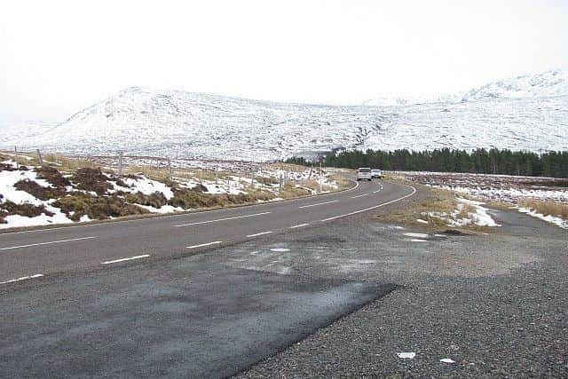
After endless hours of graft, what was created by the desperate men was the A832, a 126-mile long road which links Cromarty, on the east coast, to Gairloch on the west coast. For 125 miles, it remains in a single county, making it the longest 3-digit A road in Scotland and the fifth longest in Britain.
The roads were renumbered in 1935 with a proposal to turn the A832 into a major coastal route turned down in favour of extending the road eastwards along the former A833 to Cromarty.
Dundonnell to Braemore
The stretch from Dundonnell to Braemore is one of the most famous parts of Destitution Road. The A832 road enters the Dundonnell Gorge where it climbs alongside the waterfalls on the Dundonnell River before leaving at Fain Bridge. It then travels across open moors reaching an altitude of 332 metres where the towering peaks of An Teallach, Sgurr nan Clach Geala and Beinn Dearg surround.
Aftermath
The generosity of Scottish landlords and action by the government of the time meant that the catastrophe that befell on the Irish was narrowly avoided in Scotland, but the famine negatively impacted the already impoverished Highland population, leaving them in further despair and desperation.
Advertisement
Hide AdAdvertisement
Hide AdThe disease is thought to have affected around 150,000 people with one-third of the population leaving Scotland between 1841 and 1861. Many thousands died on the voyage or on the shores of their new world.
Destitution road remains popular with travellers and tourists alike as its fine stretch offers a unique view of the Scottish Highlands.