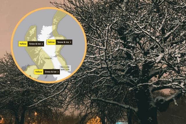
Storm Darcy: Cold weather to grip Scotland for the rest of the week before giving way to milder conditions


Temperatures remained below freezing on Friday morning across most of Scotland, although a slight rise was seen in comparison to the dramatic lows that were recorded overnight on Wednesday into Thursday morning.
Cold weather, with a continuing risk of snow, is set to grip the country for the rest of the week before milder air is forecast to gradually spread in from the west.
Advertisement
Hide AdAdvertisement
Hide AdThe transition to milder conditions is likely to be erratic as the cold pool of air currently spreading across the UK from Eastern Europe and Russia will be difficult to dislodge.
Met Office Chief Meteorologist, Dan Suri, said: “Weather for the rest of this week will continue to be very cold with daytime temperatures only reaching a degree or so above freezing at best for many and strong easterly winds continuing to make it feel even colder.”
Across the Highlands on Friday, temperatures will rise slightly above freezing with a potential high of 4C, similarly Glasgow and Strathclyde are forecast to experience another bitterly cold day but with long spells of sunshine.
Central Tayside and Fife could see a few snow showers today but otherwise can expect spells of sunny weather with low temperatures.
Dumfries, Galloway, Lothian & Borders can expect much the same as the rest of the country, a few snow showers towards the east coast and temperatures hovering around freezing for the majority of the day.
At the end of the week milder air from the Atlantic is forecast to spread into the UK behind a series of weather fronts.
These may stall where the milder air meets the cold air mass which could bring wintry hazards, such as rain, sleet, and snow, with freezing rain also a possibility at times.
Further snow showers across northern and eastern Scotland are forecast for Friday night, with conditions expected to be windier and colder than last night.
Advertisement
Hide AdAdvertisement
Hide AdYesterday, the Met Office confirmed that Wednesday night was the UK’s coldest February night since 1955, with Braemar in Aberdeenshire recording an incredible -23C.