Scotland's weather: Strong winds, ferries cancelled and power cut warning for Christmas Eve
Strong winds may cause flying debris and power cuts, and ruin last-minute Christmas getaway travel plans, forecasters have warned.
Gusts as high as 70mph are due to hit much of Scotland and northern and central areas of England on Christmas Eve.
Advertisement
Hide AdAdvertisement
Hide AdTwo separate yellow wind warnings have been issued by the Met Office, saying people should expect travel disruption, damage to buildings and power cuts, while the rest of the country may see showers during the day.
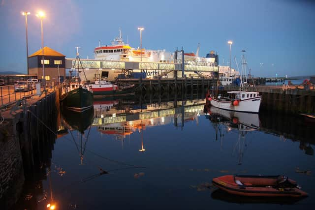

Northlink Ferries said there was a “possibility of disruption” to all services to Orkney and Shetland today given the forecasts with all crossings across the Pentland Firth from Scrabster to Stromness, now cancelled. MV Hamnavoe is now berthed in Stromness with the next scheduled sailing on Wednesday at 6.30am.
Orkney Ferries said several sailings between the smaller isles had been cancelled with disruption expected to continue on Wednesday and Thursday.
Meanwhile, Calmac said “widespread disruption” was expected over the next week on routes to the Western Isles given the forecast.
Scotrail has reported mainly minor disruption on the network today.
Met Office Forecaster Jonathan Vautrey said: “Obviously there will be quite a lot of people travelling and wanting to get home for Christmas itself.
“Particularly with these strong winds we could see some flying debris thrown on to particular roads or railway services, so if you get a tree down then that’s going to cause cancellations and delays.
“There’s the potential for isolated power cuts which will again lead to the risk of some disruption at times.
Advertisement
Hide AdAdvertisement
Hide Ad“If you’ve got a particular train that you’re catching make sure you’re looking ahead of time if there have been any cancellations.
“Just make sure you’re driving carefully, there’s the potential that high-sided vehicles could get hit by strong gusts of wind which has the potential to cause impacts, so we might see bridges closing as well.”
Meteorologist Liam Eslick said there may be snow on December 25 on mountains in Scotland but it is “not looking likely that there will be a white Christmas in England”.
He added that Christmas Day is expected to be a lot milder than usual, with the average December temperature between 7C and 8C, but the top temperature that could be seen this December 25 is 14C.
The warmest Christmas Day on record was 15.6C in 1920, so there is a “small chance” of it being a record, Mr Eslick added.
Most of the country will be damp on Monday, with heavy rain possible in Wales, though it is expected to brighten up after lunchtime.
A yellow warning for rain is in force covering much of Wales, with forecasters warning that flooding and travel disruption is possible, and will last until 6pm on Christmas Eve.
Between 20mm to 40mm of rain is expected widely and 60mm to 80mm on higher ground.