The man who went mad building Scotland's most terrifying mountain road


Today, the route in Wester Ross has become arguably one of the most famous in the world due to its inclusion on the North Coast 500 driving circuit through the Highlands.
Streams of traffic now wind over the road with car clubs drawing fleets of Mercedes, old Fords and Porsches on the road to Applecross. Motorcylists and ultra-fit cyclists also regard it as a right of passage.

Advertisement
Hide AdAdvertisement
Hide AdBut around 2,000 years ago, the route was a simple track through the glen that was well used by the Irish monk St Maelrubha and his missionaries, who founded a monastic settlement at Applecross, wrote the late Dr. Alexander Gillies of Applecross Heritage Society.
In later years, it was used as a drove road and became known as Bealach na Bà or ‘The Pass of the Cattle' that serviced the movement of stock to markets at Muir of Ord, Falkirk and London.
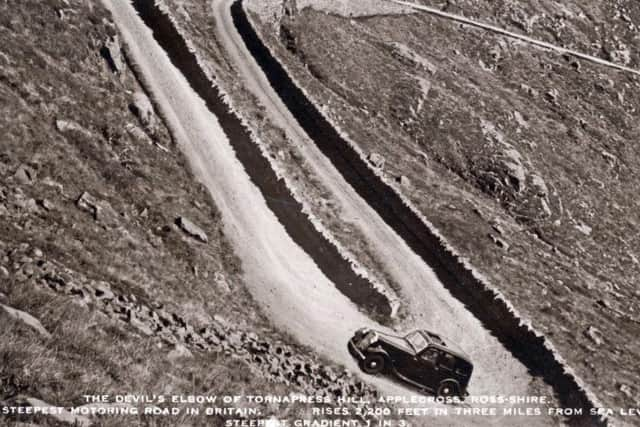
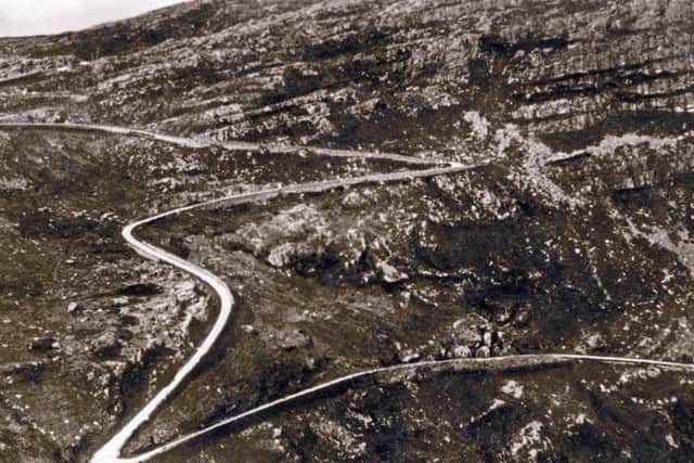
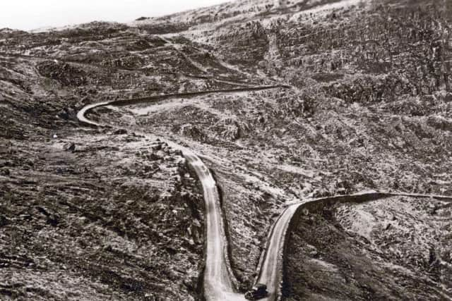
Its hairpin bends and high-altitude climb to 2,054 feet make the Bealach Na Bà an extreme driving experience for those less familiar with the road.
Indeed, a sign at the bottom might be the only on in the country warning that it might not be suitable for learner drivers.
The road that exists today came about under the influence of the popular Mackenzie landowners, who helped to open up large parts of the west coast to traffic.
Mackenzie of Gairloch was M.P. for Ross-shire from 1797-1807 and Captain Donald Mackenzie of Applecross was M.P. for Ross-shire from 1809-1815. Such was the latter's popularity that bonfires were lit for him all over his land to celebrate his election.
These two powerful proprietors owned practically all the land from Lewis to Fortrose, Dr Gillies said, with their voices carrying considerable weight in Westminster when new roads for the Highlands were being considered.
A 75% government grant - or parliamentary money - was available for the whole programme of road building with the remaining 25% paid by the landowner.
Advertisement
Hide AdAdvertisement
Hide AdDr Gillies wrote: "The most formidable part of the programme was later in starting, primarily because they couldn't find a contractor who was willing to tackle the venture.
Finally, a contract was signed with the first block of the Applecross turned on the 4th May, 1818.
Dr Gillies added: "The first contractor only lasted three months. Tradition tells us that the man went insane. Someone said it was because of all the rocks and stones which kept coming down."
And Edinburgh firm, John Reid & Son, finally finished the project in September 1822 at a cost of £4,000 - or around £500,000 at today's prices.
Workmen were paid one shilling a day with the landowners also paying for oatmeal for the contractors as well as blasting materials and a horse and cart.
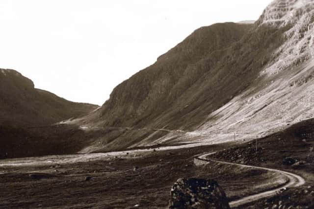
An 1898 roads guide published in Edinburgh described the Bealach na Bà as such: "Although the road has been engineered by a series of zig zags to ease the gradient as much as possible, nevertheless it is terribly steep, and the surface is wretched."
But the conditions had a fine pay off at the end, according to the guide.
"Magnificent view from the summit," it said.
Today, that view still stands.
The road could be closed for weeks on end at times with five to six foot drifts known to have formed near the summit, despite not an inch of snow at sea level.
Advertisement
Hide AdAdvertisement
Hide AdDuring these times, residents of Applecross returned to a more isolated life and relied wholly on the MacBrayne's steamer service to Stornoway and Kyle of Lochalsh to connect with the outside world. Latterly, a snow blower was used to keep the route clear.
Between 1956 and 1958, the road from Tornapress to Applecross was eventually improved.
The road was levelled and laid with Tarmac with three hairpin bends near the summit of road widened.
Passing places were added every 200 yards or so although today drivers are often likely to pull over to the verge when an oncoming vehicles appears, leading to concerns over the condition of the historic route.