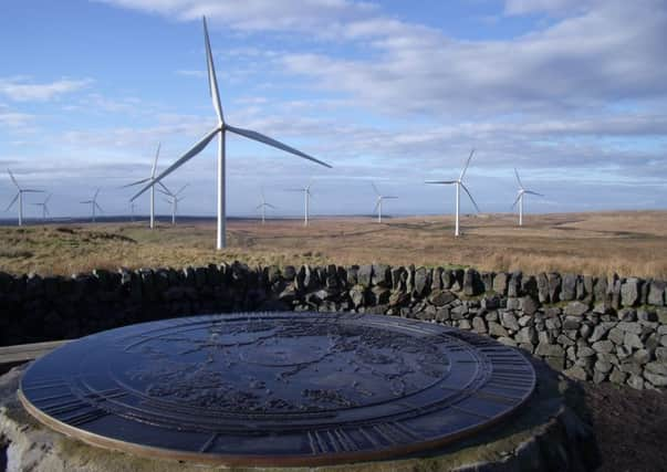
Walk of the week: Whitelee wind farm


But what sets it apart from many other waymarked routes across Scotland is that it passes right through a windfarm with its forest of turbines. And not just any windfarm either – this is Whitelee, the biggest onshore windfarm in the UK.
It may seem odd, and it is. The turbines whoosh and whirl in a very unnatural way. And to those who are vehemently opposed to windfarms sprouting up across the country, it may seem a ridiculous place for a walk.
Advertisement
Hide AdAdvertisement
Hide AdHowever, my first impressions of how the land here would look better without the whirling power generators was countered with the thought that before they existed this was a barren patch of land, largely left alone by walkers and only passed over by farmers.
So, make up your own mind, but do go. It is an experience unlike anything I have encountered anywhere else in Scotland. You can also take mountain bikes and enjoy an easy, family ride.
DISTANCE 8 miles.
HEIGHT CLIMBED 400ft.
TIME 2∫ to 3∫ hours.
MAP OS Landranger 64.
PARK Leave the M77 at junction 6 and follow the B764 towards Eaglesham. The windfarm’s visitor centre is about three miles further on, on the right.
IN SUMMARY Go back out of the main car park, away from the visitor centre, and turn right before a turbine blade lying on the ground. You pass an information board and then drop down towards the turbines. At a junction go left, then, after about another 200 yards, go right. Ignore a path going up to the left after a few yards and keep right.
At the next junction go left, then right at the following junction. Go left at the next junction and look right for your first view of Lochgoin Reservoir. The route goes right to keep above the reservoir and at the next junction it is worth going left for a detour (just over half a mile there and back) up Blackwood Hill. From the top a view finder allows you to pick out Arran, the Trossachs and as far afield as the Lomond Hills of Fife.
The main track swings left after the junction as it continues above the loch, before dropping down with views of Dunwan Dam to the left. Ignore a track on the left and continue uphill. The track swings round to the right and crosses a cattle grid. A few hundred yards after the cattle grid go right at a junction. The track drops down and swings left to follow Lochgoin Reservoir from the opposite side seen earlier. Ignore a track on the left, then, after turbine number 27, go straight on at a signpost – unless you want to detour to the reservoir dam on a path to the right.
The main track reaches a junction after about another mile – go right to drop down to a cattle grid. Go straight ahead to join a very wide track – more of an unsurfaced road – which leads up to the right. Once past some buildings (the windfarm’s control centre) the road goes left, then right before reaching a signpost. Go right here to follow a track, past the turbines again. After about a mile you reach a junction passed earlier (near where you had a first view of the reservoir). Go left and retrace your steps to the visitor centre.
REFRESH There is a good cafe at the visitor centre.
WHILE YOU ARE IN THE AREA The visitor centre is the obvious place (www.whiteleewindfarm.co.uk). Alternatively, you have the attractions of Glasgow close at hand.