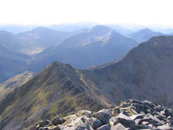
Walk of the week: The Monadhliath Carn Dearg


It has a 2 mile-long eastern face and on the western side, nestling beneath the crags of Sron nan Laogh, is the well-named and must-visit Loch Dubh.
Many hills have dearg, red, included in their names but this Carn Dearg could be the least red of them all; its name scarcely justified by small outcrops of reddish rock found near the top, but not apparent from afar.
Advertisement
Hide AdAdvertisement
Hide AdThere are three subsidiary Tops; two of them, Carn Ban and Carn Ballach, rightly demoted Munros. The nearby third Top is simply known as South-east Top.
Carn Dearg is commonly approached from the east, using the minor road above Newtonmore that leads into Glen Banchor, then a long walk by the River Calder. I prefer the more interesting and varied approach which starts by Cluny Castle on the A86, map ref 648944, heading north on a track, a public Right of Way, into Srath an Eilich to reach the Calder further upstream. Cycling on the track is assumed in the suggested time of six hours.
As both approaches, however, involve river crossings, it is advantageous to go during a dry spell. On an ideal day for hillwalking, I drove north, loaded with two bikes, to meet Rhona off the Inverness train at Newtonmore.
Park with consideration. From the Scottish Rights of Way Society green sign, follow the grassy track for a short distance to join the broad estate track. At a junction, map ref 646952, continue on the narrower track (the track to the left goes to a cottage).
From the high point at 360m, and with opening views of the Monadhliath hills, there is a short, steep descent into Srath an Eilich, a wide valley flanked by impressive ramparts. The stream in the glen is an oddity, an example of water capture from the Calder; a gentle descent noticed on the bike return.
It took us under an hour to reach Dalnashallag, an open estate bothy by the Calder. (The track, unmapped, continues west, crosses the river by ford and climbs northwards).
The mapped bridge across the Calder is no more, likewise one upstream. Crossing dry shod is often possible in summer; if more of a flow cross barefoot. (The upstream ford is the safest point to cross.) If the Calder is in spate, abandon the walk.
Advertisement
Hide AdAdvertisement
Hide AdCross opposite the hut to meet a dry at this stage ATV track that passes some ruins and a large sheep fank. The mapped path is now gone though its line is roughly followed by boggy ATV tracks beneath Sron na Creige. Cross the Allt an Lochain Duibh to join the far bank path, map ref 642996 and head towards Coire nan Laogh, a spectacular, rugged setting with steep slopes and crags.
The path, when skirting away from the river, may be difficult to follow, but before reaching the stream again, come across an ATV track which climbs NE to give the first sight of the secretive loch. Leave the track and head over dry clipped heather to reach the dip between the 923m South-east Top and Carn Macoul. It is then an easy ridge traverse to the summit cairn.
Head briefly NW, then south, to descend to the atmospheric Loch Dubh, on our day an icy mill pond beneath the snow-covered western crags. Sadly, the fisherman’s hut is no more, bits and pieces scattered downstream.