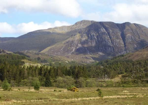
Walk of the week: Maoile Lunndaidh


In common with other remote hills there is a choice of routes, all demanding a long but satisfying day. There are two superb approaches from the east; from Strathconon into Gleann Fhiodhaig and from Glen Strathfarrar and so by Loch Monar. However, by far the most popular approach is from Craig in Glen Carron; the shortest if part cycling and with the bonus that five other Munros can be tackled on subsequent days. During our annual week at Balmacara the Craig approach best suited John and me.
In some ways more like a Cairngorm top, Maoile Lunndaidh differs from its neighbours in its mass; its plateau’s sheer size and scale best witnessed from Moruisg, at the top of the stalkers’ path above Glenuaig Lodge.
Advertisement
Hide AdAdvertisement
Hide AdThe plateau narrows at high ground between the subsidiary Top, Carn nam Fiaclan, and the summit and, with crags to the north and south, good navigation is required in adverse conditions. This high ground, Creag Toll a’ Choin, for 60 years tabled as the Munro, is still in the opinion of many regarded as the highest point rather than the “summit” cairn at map ref 135458.
THE ROUTE
Do not hang around at the Forestry Commission Craig car park on the north side of the A890. Tall trees shelter any breeze and the vegetation is a breeding ground for midges. Given the curvature of road and railway, cross with care for the start of a track. Using bicycles for the first six miles to Glenuaig Lodge is assumed in the estimated time of 6 to 7 hours.
The track goes east, crosses the River Carron then rises through the partly de-forested Achnashellach Forest. At two junctions keep to the left. Once through a gate and clear of the forest, the climb is almost over. Here the track has been improved to service a new dam on the Allt a’Chonais then it is back to the track of old, rough in places but still worth taking the bike.
Pass by the boulder-strewn gully gouged out by a stream on the western buttress of Sgurr nan Ceannaichean. Given the current wet weather we were not deflected from our Munro target. The Highland Watershed is the high point of the track after which a gentle descent leads to Glenuaig Lodge. This Victorian hunting lodge at 335m is let as self-catering accommodation; a luxury base for hillwalkers or for those simply wanting solitude. I spoke to a German couple staying there for two weeks, their third year; not for them busy hot beaches but wonderful solitude. An adjacent estate hut is a welcome shelter for hillwalkers and passers by.
Time to start walking. From the lodge a wet ATV track descends SE to cross the infant River Meig and then the An Crom-allt, the latter at a point well north of the gorge. Continue SE over rising wet peat hag moorland (Maoile Lunndaidh may mean bare hill of the wet place) to reach drier ground on the right hand (west) side of the burn that flows north from Fuar-tholl Mor, the big cold hollow.
Higher up, and by now following an obvious path, head east over flatter ground to enter a beautiful small corrie – a wonderful camping spot. The path crosses the burn then follows the south bank of the stream that flows from the low ground between Maoile Lunndaidh and Creag Dhubh Mhor. Climb southwards over grassy then stonier slopes to reach the summit plateau and the large cairn.