Walk of the week: Hawick and the Waverley Line


Considered to be the world’s first historical novel by including fictional characters among actual events, it tells of a young, aristocratic English soldier caught up in the 1745 Jacobite rising. Published anonymously at first, Scott chose the name of a town in Surrey as it had no connotations.
Waverley Station is the only one in the world named after a novel, and the 98-mile Edinburgh to Carlisle route became known as the Waverley Line. The railway reached Hawick in 1849, the terminus then of the Edinburgh & Hawick Railway. With the extension of the line to Carlisle in 1862, the original station was replaced by a new building, with a curved route leading to a 42ft-high six-arch viaduct across the Teviot.
Advertisement
Hide AdAdvertisement
Hide AdThe highly controversial closure of the line, part of the Beeching cuts, deprived the Borders of a key transport link. The final passenger service left Hawick on 6 January, 1969 – a journey memorable for protests at both Hawick and Newcastleton. The station was completely demolished by 1974, the Teviot Viaduct a year later, and by 1982 the site was levelled for the new Teviotdale Leisure Centre and car park. The area was heavily landscaped in 2000 to accommodate the nearby Waverley Road Bridge.
The 30-mile Borders Railway, covering the section from Waverley to Tweedbank, south of Galashiels, is due to be completed by September 2015; albeit very late and well above original budget estimates. Nevertheless, there must be doubts that the remaining stretch from Galashiels to Carlisle will ever be reinstated.
Meanwhile, the existing trackbed, much in excellent condition, offers many a walk, of which a three-mile stroll through the Borders’ largest town suits well for a winter’s day. Note that the route from Edinburgh to Tweedbank is a very busy construction site which walkers should avoid. There are trains operating on certain sections.
THE ROUTE:
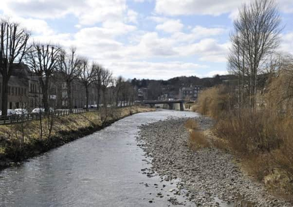
From the Teviotdale Leisure Centre (where the only sign of the old station is the edge of a loading bay, now part of the landscaped Waverley Path), go past the roundabout to reach the Teviot, perhaps firstly going upstream to the North Bridge, built in 1832, then pedestrianised when the Waverley Bridge was opened to carry the main southbound A7. Downstream from the Waverley Bridge can be seen the paltry remains of the Teviot Viaduct foundations.
Cross the bridge and go up Mart Street, once the line of a high embankment removed in 1976. Pass the bus station on the left. At the top end of the street, beyond a roundabout, is a very obvious grassy knoll with a bench; the resumption of the trackbed, reached by steps to the left, and signposted Waverley Walk.
A lovely tree-lined path leads under Melgund Place Bridge, recently renovated. The bridge over Loch Park Road is no more, so take the detour path on the left. The trackbed has been swallowed up amidst a small industrial estate but the detour to the right is well signposted. Turn left to regain the gently rising grassy trackbed which gives superb views of the town. Pass a cemetery on the left. The embankment, now a pleasant tree-lined secretive way, passes under a bridge to enter a fascinating, deep, rocky but dry cutting.
Then all of a sudden the embankment comes to an end.
The 1860 majestic six-arch viaduct that spanned the B6399 and the Slitrig Water is no more – demolished in 1982 after children were frequently caught throwing ballast onto the road below. I wonder now, as adults, what they think of their part in the viaduct’s demolition. Wooden steps, installed in 2009, ease access to the river, where there is little evidence of this once-fine bridge.
Return by the B6399 pavement or retrace steps.
MAP: Ordnance Survey map 79, Hawick & Eskdale
DISTANCE: 3 miles
HEIGHT: Negligible
TERRAIN: Trackbed and road
START POINT: Teviotdale Leisure Centre, Mansfield Road, Hawick
TIME: 2 hours
NEAREST TOWN: Hawick
REFRESHMENT SPOT: Brydon’s Bakery Restaurant, 16 High Street, Hawick