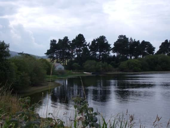
Walk of the Week: Gladhouse Reservoir, Midlothian


This is also a fine place for a walk, giving access to the empty landscapes of the hills. A low-level route can also be followed that gives a taste of this remote, high country as well as the more tranquil setting beside the gently lapping water.
Most of the route – apart from a section close to the hills – is on lanes and farm tracks. Don’t be put off by this, however, because on some days you do not meet a single vehicle.
Advertisement
Hide AdAdvertisement
Hide AdAll in all it is a great Sunday afternoon stroll. Take a packed lunch if the weather is nice and enjoy the views. It is important not to be tempted to go into the water – Gladhouse is a reservoir and therefore underwater currents can be deadly.
DISTANCE 5 miles.
HEIGHT CLIMBED 100ft.
TIME 2 to 2∫ hours.
MAP OS Landranger 66.
PARK Just less than three miles south of Temple, turn off the B6372 on a sharp bend. About a mile further on, go left to follow a minor road around Gladhouse Reservoir. After passing below the dam and reaching a T-junction, go right. There is parking on the left, just after the road has skirted the eastern edge of the reservoir.
IN SUMMARY Continue along the road with the reservoir to your right at first. As the road becomes a farm track, it veers away from the water. Go right at a junction then, once through some farm gates, take a signed footpath on the left. This leads a short way up to a field gate, which you go through.
Follow the field edge for a few dozen yards before the path veers right then left before continuing in the same direction – now between two open fields. At the far side, go through a wooden gate and follow the edge of a tree plantation on your left. Carry straight on at the end of the plantation to reach another gate which you again go through. On the other side, go right at a junction of tracks to drop down through a gate. As the track becomes surfaced, it goes round to the left to reach Huntly Cot.
After passing the stone house on the left, the surfaced road leads across a burn and round to the left to reach Moorfoot with its big house, farm and cottages. Go through the farmyard and keep straight on to follow a surfaced road past the edge of the reservoir and down to a junction.
Go right to follow a minor road for about half a mile and turn right. You are now following the road you drove in on, past the reservoir dam and round to the parking area.
REFRESH There is nothing at the start of the walk. You are best to take a packed lunch.
WHILE YOU ARE IN THE AREA Rosslyn Chapel in Roslin village has always been well worth a visit – even before The Da Vinci Code book was written.