Walk of the week: Castlelaw Hill, Pentlands


It is preferable to avoid the area when guns are making a lot of noise (and always to avoid the firing range on the south side of the hill). But the walk around the edge of this scene of warfare training and up to the top of the hill is a good way to escape into the great outdoors.
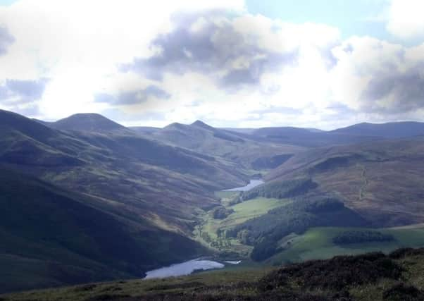
It may seem strange to head round the back of the hill before climbing it when there is a direct way up from the car park. But this route allows you to soak in the Pentlands; its glens and reservoirs, as well as the array of hilltops. And do take time to explore the Iron Age hill fort at the bottom before you leave.
Advertisement
Hide AdAdvertisement
Hide AdTo find out if live firing is taking place when you plan to go, contact Castlelaw range on 0131-310 4943.
DISTANCE 3 1/2 miles.
HEIGHT CLIMBED 820ft.
TIME 2 to 2 1/2 hours.
MAP OS Landranger 66.
PARK Turn off the A702 a little less than three miles south of the A720 Edinburgh City Bypass, following a brown sign for the Castlelaw Hill Fort. There is a car park at the end of a minor road just before a farm.
IN SUMMARY Go to the bottom of the car park and follow a sign for “Glencorse Reservoir / Flotterstone” through a wooden pedestrian gate. A path leads round to the right to reach a track in front of a barn, where you go left to walk past the MoD firing range.
After crossing a cattle grid, go right to stay on the track, which becomes grassier. At another signpost go straight ahead to continue around the base of Castlelaw Hill. The track, now more of a grassy path, veers right, away from views of Glencorse Reservoir, to begin climbing up.
Just after a section of loose stones keep to the left, following a path which stays away from the steeper slopes of the hill.
The path eventually reaches a track, where you go right. An uphill section takes you over a small hill before a short descent. At the top of a second, short rise take a path on the right which leads to a sharp bend in a track. Go right here to follow the steep track up to the 1,601ft top of Castlelaw Hill, with its flag poles.
The views are extensive; close to hand are the Pentlands with the chain of hills leading to Scald Law – the highest point at 1,900ft – to the south-west. Further afield you can see as far as the Trossachs, to the north of west, on a clear day, as well as the Moorfoot Hills to the south-east and Lammermuir Hills further east.
Advertisement
Hide AdAdvertisement
Hide AdThe easiest way down is to retrace your steps to the sharp bend and then stay on the track to a junction, where you go right. You can meet the track further down by heading slightly south of east from the top, following a fence on your right (don’t cross it as the firing range is on the other side). Although quicker, this is quite a steep descent and can be a bit slippery after rain.
Either way, the track leads past Castlelaw Hill Fort to the car park.
REFRESH There is nothing at the start of the walk. Try the Flotterstone Inn, less than a mile further down the A702.
WHILE YOU ARE IN THE AREA The hill fort is well worth a visit, www.historic-scotland.gov.uk