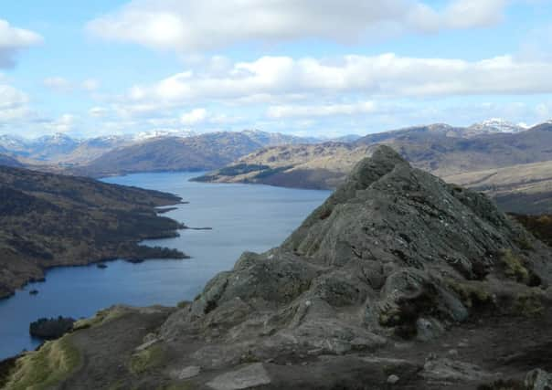
Walk of the week: Ben A’an, The Trossachs


Early in the morning I had headed here for a great little walk, which still left enough time to fit in family commitments later in the day. The advantage of the early start meant my only company was the sound of bellowing red deer – reassuringly in the distance.
Even without the peace and quiet brought by the dawn start, it is easy to see why this walk is enjoyed throughout the year. However, the popular path up has just been closed by the Forestry Commission while their work of chopping down trees takes place until autumn 2015. Fear not, as an alternative route has been created (described here).
Advertisement
Hide AdAdvertisement
Hide AdSo, if you have never been up to the top, you can still go. And, if you have, you can enjoy discovering a different route up the lower slopes. Boots are needed because the alternative route is muddy. But it does have the advantage of passing through birch trees rather than forestry.
DISTANCE: 3 miles.
HEIGHT CLIMBED: 1,250ft.
TIME: 2 to 2 1/2 hours.
MAP OS: Landranger 57.
PARK: A couple of miles west of Brig o’ Turk on the A821, pass the (currently closed) Forestry Commission car park for Ben A’an and continue ahead. After the road bends left, go right, into the Forestry Commission car park for Ben Venue.
IN SUMMARY: Follow a path on the right hand side of the car park, signed “diversion”. After about 20 yards, go right, on a path that has been cut through bracken, to reach the minor road leading to Loch Katrine.
Cross the road and follow a path which bears right then climbs a bank to a grassy track, where you go left.
After dropping slightly, then regaining height, go right, into forestry. This steep section bears right and continues through birch trees, below the daunting outline of Ben A’an’s pointed summit – don’t be put off, the path to the top is actually easy, if steep.
You eventually emerge on a firmer path – the usual route up. Go left and walk up to a clearing, where the final, strenuous section starts. Follow the right hand side of a burn before crossing over and continuing uphill until the gradient eases just below the summit. The path then almost doubles back on itself to reach the two rocky outcrops at the top.
Spend as much time as you can here – the views are superb. As well as down Loch Katrine to the Arrochar Alps, the eye is drawn over to the bulk of Ben Venue to the south, the Campsies further afield, east to Ben Ledi and north to the mountains above Crianlarich.
Advertisement
Hide AdAdvertisement
Hide AdAfter spending time exploring the summit rocks, most return the way they came, and this is the easiest option. An alternative is to head to the north and west to reach the shore of Loch Katrine. This, however, is pretty rough terrain and can be very wet underfoot.
REFRESH: Head to The Trossachs Pier, which has a hut serving tea, coffee and ice-cream, or to the Brenachoile Restaurant on the hill above.
WHILE YOU ARE IN THE AREA: At Loch Katrine you can hire bikes or enjoy a cruise on the water, until boat trips stop for the winter after next weekend (www.lochkatrine.com).
Otherwise, enjoy a drive over the scenic Duke’s Pass towards Aberfoyle (keep going on the A821 in the direction you drove in on.)