Walk of the week: Beinn Iutharn Mhor


Both approaches have the benefit of a 350m starting height, but from Spittal of Glenshee one mile can be saved by driving to Dalmunzie House Hotel where there is a £2 parking fee.
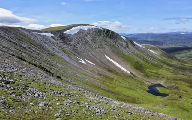
The hill, in the form of a NE-facing horseshoe enclosing the Allt Beinn Iutharn, has three prominent points, 1,045m/3,428 ft Beinn Iutharn Mhor itself on the NW side, and two subsidiary Tops, 953m Beinn Iutharn Bheag to the east and the more rounded 986m Mam nan Carn to the south. The summit has a large quartzite cairn and the walk to it along the northern arm of the horseshoe, a beautiful high-curving one-mile stretch, gives full appreciation of the hill’s name, big sharp-ridged hill. The southern arm of the horseshoe is less dramatic, but beneath it is the enchanting and secretive Loch nan Eun which drains to the pleasing Gleann Taitneach – and the route I used a few weeks ago.
Advertisement
Hide AdAdvertisement
Hide AdAt a height of 785m, the loch regularly freezes over. Heading for Beinn Iutharn Mhor on a wintry, silvery day in 1984, Geraldine and I inadvertently crossed the frozen loch. With a sense of foreboding, we realised that the level ground should have been rough terrain on a curving route round the edge of the loch. Watched by a disdainful fox, we inched our way forward to the now recognised rough ground. We were more careful on return.
If not taking a bicycle, it takes only a little longer to reach the summit by first traversing Glas Tulaichean, but that misses out on the quicker partly freewheeling return down Glen Taitneach.
Map Ordnance Survey map 43, Braemar & Blair Atholl
Distance 13 miles of which 7 miles cycled
Height 700m
Terrain Track, path and grassy hillside
Start point Dalmunzie House Hotel, Spittal of Glenshee, map ref 091712
Time 6 hours
Nearest towns Braemar and Blairgowrie
Refreshment spot Dalmunzie House Hotel
The route
Just west of Dalmunzie House Hotel, turn right as signed by a white gate for an unmapped grassy track/path on the west side of the Allt Ghlinn Thaitneich. After almost a mile, a somewhat insubstantial footbridge spans the river, and so to the rough in places, but much improved track through the glen. Three streams have to be forded; the immediate one from Coire Shith, then the Allt Aulich and finally the Allt Elrig. There may be problems in times of spate. Continue to where the track crosses the river, map ref 076761, a point cycled within one hour.
Follow the path on the east bank of what is now the bustling Allt Easgaidh and so into the enclosed upper glen. After passing a series of waterfalls, comes the sudden pleasing appearance of Loch nan Eun, loch of the birds, and whose trout are said to be as fine as in any river or loch in Scotland. The western side unmapped path goes past a ruin by which is a small boulder with a metal ring for mooring boats.
Once over some peat hags, climb NW on rough heathery but drier slopes, seeking out traces of animal or boot paths, to reach a height of circa 900m on the Mam nan Carn/Beinn Iutharn Bheag ridge. Maintain that height for a grassy traverse (a vague path is more obvious on return) to reach the broad 910m saddle between Mam nan Carn and the summit. If misty, navigate first to Mam nan Carn.
Grassy then increasingly quartz-covered slopes lead to the very large cairn. It was a glorious day as forecast with excellent views all round, including north to Cairn Toul where Jimbo and John had headed.
Then it was back to Dalmunzie House Hotel for coffee and scones.