Walk of the week: Tinto, Lanarkshire


A simple route following a good path which leads to great views across Scotland is the perfect way to blow away some cobwebs or energise yourself for the week ahead.
Despite its remote appearance, people have been here before. It is said that the 2,320ft hill had Druidic significance and that Tinto – Hill of Fire – was used for ceremonies honouring Baal, the Sun god.
Advertisement
Hide AdAdvertisement
Hide AdMore visible evidence of ancient man is seen near the start of the walk with the grassed-over remains of Fallburn Hillfort, dating back to pre-Roman times. Also, the large cairn at the summit is 3,500 years old – built during the Bronze Age.
Do this walk on a clear day because the views really are superb, stretching from west to east coasts, north to the Highlands and south to England. A picnic is a superb idea, especially as this walk is suitable for families but little legs may need a few rests on the way up.
DISTANCE 4∫ miles.
HEIGHT CLIMBED 1,550ft.
TIME 2∫ to 3∫ hours.
MAP OS Landranger 72.
PARK About four miles south of Hyndford Bridge along the A73 turn right at the old Tinto Hill tea room. The car park is about 250 yards down the road, on the left immediately after a cattle grid.
IN SUMMARY From the car park go through a gate to the right of an information board and follow the path running parallel to the road. As the road swings away to the right, the path follows a straight line to reach a kissing gate, which you go through.
Once past the gate, you follow the broad track under some electricity wires. The path levels out before rising again for a long climb up Totherin Hill, an outlier of the main summit.
After about half a mile, look back to the right of the path, just before the electricity wires, and you can clearly see the remains of the 2,000-year-old Fallburn Hillfort. As the path bends to the left the gradient eases, but you are confronted with a view of the steep climb a little further on. However, the cairn to your left, which marks the top of Totherin Hill, also indicates the halfway point.
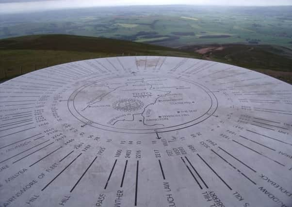
At the top of the slope the path forks and you should go left. It then bears right before the final uphill push to the top and its large summit cairn dating back to the Bronze Age and view indicator. On a clear day you can look north to the Trossachs and south to the English border. The view east to west stretches from coast to coast. The trig point is to the right, on the other side of a fence. After enjoying the view, retrace your steps to the car park.
Advertisement
Hide AdAdvertisement
Hide AdREFRESH Just up the A73 is the Carmichael Estate Farmhouse Kitchen.
WHILE YOU ARE IN THE AREA The 18th century cotton mill village of New Lanark is a World Heritage Site and well worth a visit. www.newlanark.org