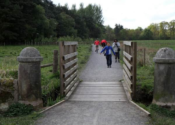
Walk of the week: The Loch Leven Heritage Trail


The trail cost £3 million, of which £800,000 was used for the four-mile final section, where the principal donor was the Heritage Lottery Fund.
Further contributions included a bequest from the late Jean Lindsay, a member of the congregation at Cleish Church, who gifted £83,600. She had greatly enjoyed the existing trail and wanted it to be completed. Furthermore, the final section was made possible by the generosity and willing co-operation of the landowners.
Advertisement
Hide AdAdvertisement
Hide AdThe first phase of the trail, a three-mile stretch on the northern side of the loch from Kinross to Burleigh Sands, started in 2006. The second phase extended the trail to Vane Farm, at which time I wrote: “Plans still remain to complete the final phase round the south-west end of the loch, albeit that may take a couple of years. I look forward to that. The pleasure of both these sections has convinced me that the complete 13-mile circuit path will quickly become a favourite central Scotland low-level walk.”
And so it has proved to be. The final section, at times surprisingly distant from the loch side, is not as attractive or wooded as the earlier sections, though doubtless time will change that.
Loch Leven, Scotland’s largest lowland loch, is famous for its brown trout and is also home to thousands of breeding and wintering birds. Dogs must be kept under proper control at all times. With access points for walkers, cyclists and wheelchair users, the trail provides a low-level, partly sheltered outing – ideal for Jimbo and me on our grey winter’s day.
Loch Leven is on Ordnance Survey map 58 (Explorer map 369 gives more detail), but neither is really needed. Just stay with the path.
THE LOCH LEVEN HERITAGE TRAIL
MAP Ordnance Survey map 58, Perth & Alloa
DISTANCE 4 miles
HEIGHT Negligible
TERRAIN Superb path
START POINT Vane Farm car park, off the B9097, map ref 160990
TIME 2 to 3 hours
NEAREST TOWN Kinross
REFRESHMENT SPOT Vane Farm cafe
THE ROUTE
From the Vane Farm car park, map ref 160990 (by the B9097 on the south side of the loch, two miles east of the M90) go past the RSPB buildings to reach the pedestrian subway under the road. Once through that, turn sharp left as signed, Lochleven Mills 6km (3.7 miles). The perimeter path goes westwards, parallel to the road and on the south side of the reserve, then curves right by the south-west corner of the reserve to a hillock – at 125m, the highest point on the trail.
Dedicated to the memory of Jean Lindsay, this is the East Brackley viewpoint, the trail’s best open panoramic view of the distant loch and surrounding area. Another sign shows Lochleven Mills 4¼km (2.6 miles).
Advertisement
Hide AdAdvertisement
Hide AdA short zigzag descent from the viewpoint leads to the west side of the reserve. Eventually the path turns to reach the Gairney Water, later crossed by a new footbridge. The loch side is now close by.
Later, slanting in from the left is the grassy overgrown track bed of a dismantled railway (to contrive a shorter Edinburgh-Perth route, via the Forth Bridge, the North British Company in 1890 doubled their existing lines from Kelty to Kinross and Milnathort, and undertook new construction including two tunnels through Glenfarg). The path goes parallel to, but surprisingly does not use, the track bed – by now with traces of ballast. On reaching the Todd & Duncan building, turn right as signposted: Kinross Pier ½km (to the left is Lochleven Mills car park). Continue by the loch side and a bridge over the Killoch Burn to reach the pier on the south side of Kinross – and perhaps a pre-placed car.
Having mostly cycled to the pier, Jimbo and I continued by bike for a most enjoyable circuit of the loch.