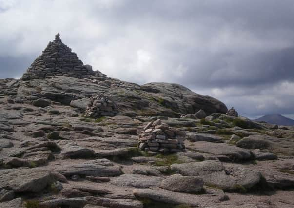
Walk of the week: Munros challenge - Cairn Gorm


So, I set off by the funicular railway in Coire Cas and started the walk up Cairn Gorm. The superb views of the Northern Corries ahead and the forests of Glenmore and Rothiemurchus behind went some way to taking my mind off the twinges of pain, but in reality it was the stretching that goes into uphill walking that started to work.
By the time I got to the Ptarmigan restaurant at the top of the funicular my back was better than it had been for more than a fortnight, so after a quick coffee (it does seem strange to have an espresso at 3,600ft) I set off for the summit.
Advertisement
Hide AdAdvertisement
Hide AdThe cloud was scudding over the huge summit cairn but glimpses of the shattered rocks of Coire an t-Sneachda were still possible and this most accessible of the 4,000-footers was mine to enjoy pain-free – this walk could be prescribed by the NHS.
I did take the railway down as, while going up may be good for the back, going down can jolt it, which would see a return of the soreness. The next day I woke to find there was no need for anti-inflammatory drugs and another hill was taken in, showing that a good walk really can cure a range of ills.
Distance
4 miles.
Height climbed
2,000ft.
Time
2½ to 3 hours.
Map
OS Landranger 36.
Park
Take the B970 from Aviemore through the Rothiemurchus and Glenmore Forests. Go past Loch Morlich and up to the Coire Cas car park, next to the funicular railway station.
In summary
Go past the mountain railway station, on your left, and walk under the track. A few yards further on go left, up a path through heather signed “Windy Ridge Path”.
The path leads all the way up to the Ptarmigan restaurant at the top of the railway and is steep at first before the gradient eases as you cross ski slopes.
Go round the back of the building at the top of the railway and take a path up to the left, starting between two blue ropes. At the end of these a straight line of cairns leads to the large summit cairn and weather station beyond. Return the same way or via a track which starts to the left of the Ptarmigan restaurant as you approach it from the summit.
Refresh
There is a good café at the start of the walk, as well as the Ptarmigan restaurant at the top of the funicular railway.
While you are in the area
Advertisement
Hide AdAdvertisement
Hide AdThere is enough to keep you occupied for weeks. As well as the scenery there is a wide range of activities including sled dog rides, reindeers and hiring a boat on Loch Morlich (www.forestry.gov.uk/glenmoreforestpark).