Scottish walks: Four of the best this summer holiday


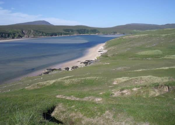
Kyle of Durness, Sutherland
Distance: 6 miles.
Height climbed: 300ft.
Time: 2½ to 3½ hours.
Map: OS Landranger 9.
Park: There are parking bays by the roadside at Balnakeil. If coming from the south, turn left off the A838 at Durness and follow a minor road for about a mile to Balnakeil Bay.
In summary: The swirling sands of the Kyle of Durness turn into magical patterns as the tide goes in and out, making the walk along its edge one of the best short outings on the coastline of Scotland. Starting at Balnakeil Bay’s white sands, backed by high dunes, you follow little cliffs and machair on a circular route which returns by a single track road and grassy farm tracks.
Schiehallion, Perthshire
Distance: 7 miles.
Height climbed: 2,460ft.
Time: 4 to 5 hours.
Map: OS Landranger 51.
Advertisement
Hide AdAdvertisement
Hide AdPark: Take the B846 out of Aberfeldy and after nine miles turn right, following a sign for the Schiehallion Road. A little over two miles further on turn right into the Braes of Foss car park.
In summary: Schiehallion is in the middle of the central Highlands and offers views in all directions, with the eye being drawn over Rannoch Moor towards the mountains of Glencoe and Lochaber. Great path work by the John Muir Trust has not only reduced erosion but made the way up a lot easier, and although it is a Munro, it can be climbed by any healthy member of the family.
Lunan Bay, Angus
Distance: 6 miles.
Height climbed: Negligible except a short, steep climb up to Red Castle.
Time: 3½ to 4½ hours.
Map: OS Landranger 54.
Park: North of Inverkeilor on the A92 between Arbroath and Montrose turn off at a sign for Lunan. Once in the village turn left then right, following a sign for the beach down a farm road. At the end is a car park next to sand dunes.
In summary: Lunan Bay is a great expanse of sand, perfect for a family outing; some will want to sit with a picnic or have a paddle while others can stride out and enjoy a coastal walk taking in the ruins of the 12th century Red Castle. At the southern end you can walk along the top of cliffs before looking back along this beautiful stretch of Angus coast.
Criffel, Solway Coast
Distance: 3½ miles.
Height climbed: 1,740ft.
Time: 3 to 3½ hours.
Map: OS Landranger 84.
Park: Two miles south of New Abbey on the A710 turn right on to a track at a farm sign for Ardwall Mains. At the end of the track there is a car park, on the right.
In summary: Criffel, to the south of Dumfries, looks out across the Solway Firth to England. A steep clamber up its heather clad slopes rewards you with brilliant views, including the salt marsh and sand flats which form marbled patterns at the delta of the River Nith. Beyond stand the mountains of Cumbria’s Lake District and, on a clear day, the Isle of Man, and even the coast of Ireland.