Glasgow's unbuilt Inner Ring Road


The history of Glasgow’s M8 can be traced back to the Bruce Report of 1945 which envisaged a rationally-planned, modern utopia encircled by a ring of dual carriageways and arterial roads splaying outwards from all four corners of the inner city.
Much of the report - including the wholesale destruction of Glasgow city centre - was ultimately shelved, but subsequent planning dossiers brought the road proposals back to life.
Advertisement
Hide AdAdvertisement
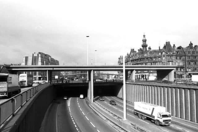
Hide AdConstructed between 1965-72, the 2.7-mile-long route, which we now classify as part of the M8, traverses the northern districts of Townhead and St George’s Cross before darting south, carving a deep ravine through Charing Cross and Anderston then rising once more to cross the Clyde via the Kingston Bridge.
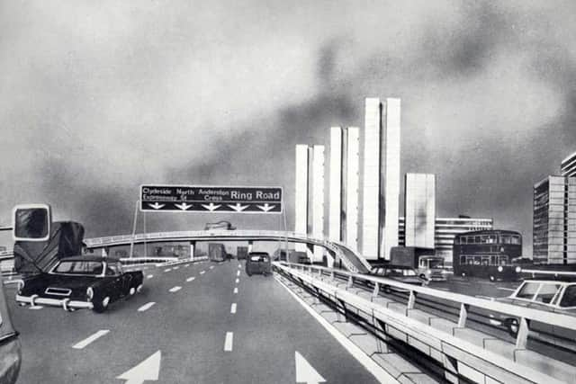
The route forms what had been intended to be the Inner Ring Road’s north and west flanks. Its completion would have resulted in untold destruction throughout Glasgow’s High Street and Merchant City, threatening historic landmarks such as Glasgow Cathedral, Provand’s Lordship and the Tolbooth Steeple.
It was not to be. The two remaining flanks of Glasgow’s Inner Ring Road, as well as a proposed motorway extension through Maryhill, were abandoned at the start of the 1980s following significant public opposition to the continuation of the works.
One of the great myths surrounding the Inner Ring Road is that large swathes of Glasgow city centre were scythed-down to build it.
According to Stuart Baird, administrator of history website Glasgow’s Motorways, this was not the case: “80% of the motorway was constructed on open, undeveloped land.
“Glasgow Corporation had already established a number of comprehensive development areas, where 95% of poorer housing had been earmarked for demolition. The fact is that districts such as Townhead and Anderston, where the motorway now runs through, would have largely disappeared anyway.”
And, despite its bad press over the years, Stuart is adamant the urban motorway has had an overwhelmingly positive impact for Glasgow: “Traffic in central Glasgow is 30% less today than it was in 1960, and a journey that would once take you 60 minutes at 5 or 6 miles per hour now takes less than 15.
Advertisement
Hide AdAdvertisement
Hide Ad“We also happen to boast one of the UK’s top retail districts outside of London thanks to the likes of Sauchiehall Street, Buchanan Street and Argyle Street being pedestrianised - that just wouldn’t have been possible without the M8.”
Few motorists, or indeed shoppers, would argue with that assessment.
However, the abandonment of the remainder of the Inner Ring Road and its various connections has left a number of “visible loose-ends”.
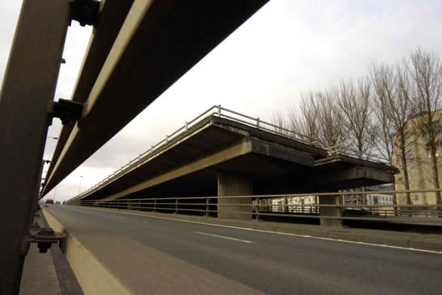
Just south of the Kingston Bridge at Tradeston, is one of the most famous, commonly referred to as the “ski-jump”; an incomplete junction which rises into the air before terminating abruptly. The ski-jump had been intended to link with the south section of the ring road. Instead, it hangs forlornly, waiting for a connection which will never be built.
North of the Clyde at Charing Cross, a large podium, which many mistook for an unused bridge, stood empty until the 1990s when it was finally furbished with an office block as intended.
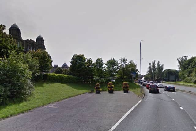
And at Townhead, and St George’s Cross there are more dead ends; slip roads which dart off suddenly before coming to a sudden stop. In an alternate universe, the ghost road at St George’s Cross would have led to a completed Maryhill Motorway.
Finally, in the Gorbals, a short section of Lauriston Road becomes dual carriage just as it approaches the corner, mirroring the turn in the road a mile to the west where the Tradeston “ski-jump” is located. Although the dual carriageway was added much later than the 1970s, it is likely that this land had been set aside in preparation to meet the ring road’s south flank.
Advertisement
Hide AdAdvertisement
Hide AdSpeaking of which, many would now argue the requirement for such a road has now been fulfilled.
In 2011 the £700 million M74 extension, bridging the 5 mile gap between Hamilton and the M8 at Tradeston was completed. Taking in much of south east Glasgow and bypassing the Gorbals and Eglinton Toll, the M74 extension performs a similar function to the proposed south section of the Inner Ring Road, albeit located slightly further south.
All that’s missing now is the Inner Ring Road’s east flank - but don’t hold your breath.