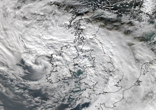
Scotland to escape full force of storm Barney


The second storm to have an official name is rapidly sweeping across the Irish Sea, bringing heavy rain and strong winds to many parts of the UK. Outbreaks of rain across southern parts of Scotland today are linked with Barney, but Met Office forecasters say the storm’s most devastating effects will not be felt north of the border.
However, Scots should not hang up the bad-weather gear just yet.
Advertisement
Hide AdAdvertisement
Hide AdThe Met Office is warning that a separate “nameless depression” will see south-western coasts blasted by winds reaching up to 70 mph.
Operational meteorologist Stuart Brookes said: “Barney will have blown over to Denmark by the morning.
“The strongest winds hitting Scotland will come from a separate low pressure system.
“There will be gales across southern parts, reaching up to 70 mph on the Argyll and Ayrshire coasts and up to 60 mph inland.
“These winds are not related to parney, but are part of another as yet nameless depression.”
Barney comes hard on the heels of Abigail, the UK’s first ever named storm, which left thousands of homes without power and schools closed in parts of Scotland.
The latest storm has already brought winds up to 81 mph, with areas across the south of England and Wales expected to feel the full brunt tonight.
Heavy rainfall is also predicted in Northern Ireland, Wales and north-west England as well as the strong winds, which could disrupt flights and other transport.
Advertisement
Hide AdAdvertisement
Hide AdAccuWeather meteorologists are predicting up to two inches of rain may fall in some areas.
Meteorologist Eric Leister said: “Barney will be a fast-moving storm, bringing locally strong winds to southern Ireland and the southern UK, beginning midday Tuesday and continuing into Tuesday night.”
A yellow “be aware” warning for strong winds has been issued for parts of Wales, southern, central and eastern England for this afternoon and into the evening, as a series of low pressure systems move in from the Atlantic bringing unsettled weather.
There is also a weather warning for rain in the next few days centred on the north west of England and Wales, coming hard on the heels of torrential rain which saw rivers burst their banks and localised flooding affecting roads, farmland and train services.
The Met Office is warning that given the already saturated conditions, communities could see more floods from standing water or swollen rivers that could lead to travel disruption.
People were also being urged not to pose for “storm selfies” which could put their lives in danger.
The public are advised against trying to take photographs of themselves on promenades and piers as they are battered by powerful waves.