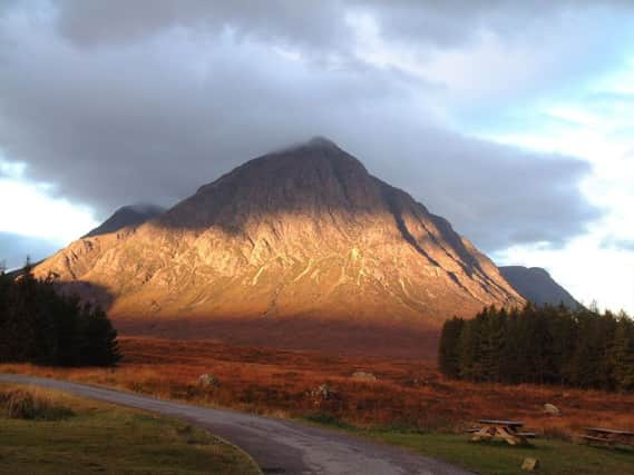
Walk of the week: Buachaille Etive Mor


Invariably photographed from Kings House Hotel, Stob Dearg is the Buachaille’s most dramatic point; a rocky buttress with many classic climbing routes. The lowlier Stob na Broige, whilst lacking the dramatic setting of Stob Dearg, appeals to many for its seclusion, away from the bustle of Glen Coe and the A82.
Stob na Broige only achieved Munro status in 1997, thus increasing the popularity of traversing the whole length of the Buachaille and passing two subsidiary Tops – 1,011m Stob na Doire (just 11m lower than Stob Dearg, a fine isolated top according to Hugh Munro and thought worthy of separate status at one time) and 941m Stob Coire Altruim. It neither looks nor feels right that the less impressive peak of Stob na Broige should be a Munro in preference to Stob na Doire.
Advertisement
Hide AdAdvertisement
Hide AdStob na Doire is a good 40 minutes’ walk from Stob Dearg and with a climb of 144m. Albeit further distant from Stob Dearg, Stob na Broige has a lower height and a lesser climb of 134m. If Stob na Doire is excluded on the basis that it is just a bit too near to Stob Dearg to comfortably handle promotion, then Stob na Broige’s promotion is justified because the cumulative ascent along the ridge is over 300m. One solution would be to upgrade the Buachaille to a three-Munro mountain.
The popular well-pathed route approaches via Coire na Tulaich, however the north facing upper corrie rim may present difficulties in winter and even in late autumn. Quite a few walkers have slipped here, and there have been fatalities.
Map Ordnance Survey map 41, Ben Nevis, Fort William & Glen Coe
Distance 8 miles
Height 1,200m
Terrain Vague path in corrie ascent; good path thereafter
Start point Glen Etive road by Allt Coire Cloiche Finne, map ref 219520
Time 6 to 7 hours
Nearest village Glencoe
Refreshment spot Kings House Hotel, Rannoch Moor
THE ROUTE
Jimbo and I prefer the quieter, albeit lower start from Glen Etive, map ref 219520, and into the open Coire Cloiche Finne. A modest scramble on the corrie’s east side ridge goes direct to Stob Dearg, but an easier approach is to follow the east bank of the stream (a dried-up river bed on our day) to a Y junction.
A zigzag grassy path between the streams leads to the upper corrie. Now pathless, gradually curve right above a rocky rib to reach the narrow neck of the ridge by 902m Stob Coire na Tulaich where it may be a shock to meet the many using the popular route.
A multi-cairned zigzag path eases the ascent on the scree-covered west ridge. As the ridge narrows, continue to the last of three cairns, almost to the edge of the buttress high above Rannoch Moor – one of the best viewpoints in Scotland – good to look at and good to be on top!
Return to Stob Coire na Tulaich for the delightful, rocky and twisting two-mile traverse. A steep rise, then descent, from the conical top of Stob na Doire leads to Stob Coire Altruim and the easier walk to the rocky peak of Stob na Broige. Well seen and much photographed from lower Glen Etive, there is an air of tranquillity, enhanced by the peaceful setting of the distant sea loch.
Advertisement
Hide AdAdvertisement
Hide AdReturn to Stob Coire Altruim from where it is a steep, stony then grassy descent to Glen Etive. However, for the canny hillwalker the easiest, albeit longer return is to descend north on the mapped and improved Lairig Gartain path, and so to the A82 car park, map ref 213560 – and a pre-placed car or bicycle.