Walk of the week: Glengaber Hill & Welshie Law


Never having been there before, I was surprised to note how close, but 3 miles to the south-east across the Yarrow Water, is Fastheugh Hill traversed on the recent Duchess’s Drive at Bowhill.
Even closer, just 2 miles on the north side of the Yarrow Water, is Minch Moor which I wrote about in 2006 as part of a special celebratory 75th anniversary walk along part of the Minchmoor Road, from Traquair to Broadmeadows, to celebrate the opening of the Scottish Youth Hostel Association’s very first hostel. I was delighted to be invited because Broadmeadows was my very first hostel and the walk was my personal trip down Memory Lane.
Advertisement
Hide AdAdvertisement
Hide AdBut back to Glengaber Hill and Welshie Law. It is a 10-mile outing over mixed terrain; by track beside the Fingland Burn to Camp Shiel, then a narrow grassy path by Camp Shiel Burn to a track running south through Elibank and Traquair Forest. Once clear of the trees, gentle grassy slopes lead to both of the hills.
A western descent then leads to the high ground of an old way from Traquair to Yarrow.
Map Ordnance Survey map 73, Peebles, Galashiels & Selkirk
Distance 10 miles
Height 500m
Terrain Tracks to grassy hillside then rougher descent to track
Start point Traquair village hall by B709/ B7062 junction, map ref 332346
Time 5 hours
Nearest town Innerleithen
Refreshment spot Osso, 1 Innerleithen Road, Peebles THE ROUTE Start from Traquair village hall by the junction of the B709 and B7062, map ref 332346, where the Southern Upland Way crosses the former and follows the Minchmoor Road. However, walk along the B709 with care to the Fingland Bridge and track to Damhead. By the road-side is a signpost – Yarrow Valley via Glengaber, 8 miles.
Follow the track for some 200 yards to Damhead where the track forks. To the right (with a Tweed Trails sign with a white arrow) is the return track. However, continue by the Fingland Burn with a gentle rise into more open country. Go past Damhead Shiel and so to Camp Shiel from where the mapped track heads east into the fringes of the Elibank and Traquair Forest. The track, in fact a well-trimmed grassy way with the lovely garden of Camp Shiel on the left, later becomes a narrow path, somewhat muddy on our day.
A steady rise leads to the forest track below the slopes of Minch Moor. Turn right and head southwards with limited views at first but later at a wider clearing take time to admire the open views over Glen Gaber, glen of the goats, and Glengaber cottage. A gentle descent leads to a waymark sign where the track, at this point little more than a narrow grassy way between the trees, clears the forest by the base of Glengaber Hill.
Advertisement
Hide AdAdvertisement
Hide AdSlant right to a gate, from where there is a choice of routes. The most direct is due south by a line of fence posts. However, we opted for a curving route on the north-east side of the hill, following the vague at times mapped path to reach the dip between the hill and Peatshank Head. A lovely grassy way by a line of fence posts leads to Glengaber Hill, a rounded grassy dome with no cairn.
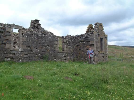
Continue by the line of fence posts with a modest drop and rise to Welshie Law, which does have a handful of stones to mark the high point and with good views especially towards Innerleithen. Continue following the grassy way which curves right then left to rejoin the fence posts by the dip at map ref 329298. Descend north heading for the ruins of Hannel. As the immediate mapped paths have been lost, it is best to keep left on approaching Hannel Bog. However, once at Hannel, a lovely grassy track gives a charming return route to Damhead.