Met Office issues ‘rare’ red warning for winds of up to 90mph in parts of UK


Large parts of the UK are set to be battered by strong winds after the Met Office issued a red weather warning.
Parts of eastern Scotland and northeast England are expected to be worse hit by the weather, which comes as Storm Arwen prepares to wreak havoc across the UK.
Advertisement
Hide AdAdvertisement
Hide AdBut what warning is in place, and what does it mean for people in these areas?
What does a red weather warning mean?
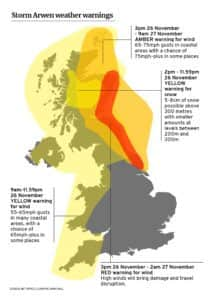
On the morning of Friday (26 November), the Met Office issued a red weather warning for high winds across the east of the UK.
The red weather warning is rare and indicates that the severe weather conditions may pose “a danger to life”.
The area affected includes eastern Scotland and northeast England, encompassing busy cities such as Edinburgh and Newcastle-Upon-Tyne.
An amber warning for wind is in place surrounding the affected area.
The Met Office said: “A spell of exceptionally strong northerly winds will affect eastern coastal districts of Scotland from later this afternoon moving south into south-east Scotland and north-east England this evening.


What can be expected during the red weather warning?
During a red weather warning, there are severely strong winds which will affect the day-to-day running of things like transport and mobile phone connectivity.
Winds are expected to reach between 80 and 90mph.
During the red weather warning, The Met Office has said that flying debris will be expected.
Advertisement
Hide AdAdvertisement
Hide AdThere may be damage to buildings and homes, including roofs blown off and power lines brought down.
Power cuts can also be expected, also affecting services such as mobile phone coverage.
Can I drive during a red weather warning?
Transport is expected to be affected by Storm Arwen.
Roads, bridges and railway lines may be closed, with delays to bus, train, ferry and flight schedules.
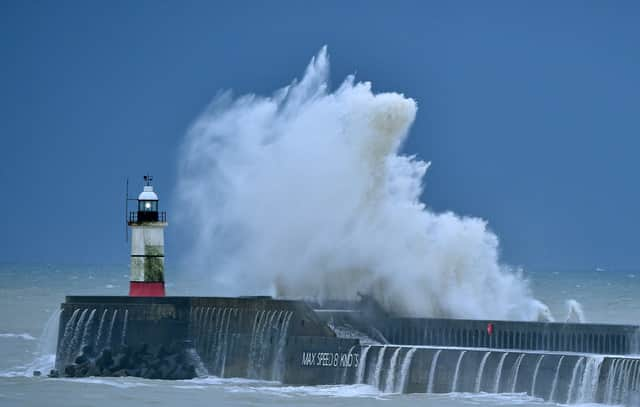
Due to the coastal location of the red weather warning, large waves are expected to impact coastal roads, sea fronts and homes.
Advice says not to attempt to drive during the storm unless the journey is necessary.
If driving, exposed routes, such as bridges, should be noted and alternative route mapped if needed.
How do I stay safe during the red weather warning?
During a storm, Met Office advice says to stay indoors as much as possible and not to drive unless the journey is necessary.
You should not attempt to go outside to repair damage while the storm is ongoing
Advertisement
Hide AdAdvertisement
Hide AdMet Office advice says that loose objects in the garden, for example ladders or furniture, should be secured to ensure they are not lifted by winds and consequently damage property.
Vehicles should also be parked in a garage where possible to reduce the likelihood of them being damaged by any debris.
After the storm is over, there should be care to not touch any electrical or telephone cables which have been blown down.
When is the red weather warning in place until?
The red weather warning is expected to last from Friday at 3pm until Saturday at 2am.