

And, as time marches on, the interactive technology allows us to track the city’s innumerable changes in a way that has never before been possible.
Using Google Street View’s inbuilt time slider function, we take a look at 9 Glasgow views that have changed almost beyond recognition since the American multinational tech firm first visited the city in 2008.
A message from the Editor:
Thank you for reading this article. We're more reliant on your support than ever as the shift in consumer habits brought about by coronavirus impacts our advertisers.
If you haven't already, please consider supporting our trusted, fact-checked journalism by taking out a digital subscription at https://www.scotsman.com/subscriptions.

1. Queen Street - then
Long regarded an eyesore, the concrete-clad Bank of Scotland building on the corner of Queen Street and Ingram Street has been demolished since this image was taken. Photo: Google Street View

2. Queen Street - now
The Duke of Wellington's cone can still be seen today, but the 1960s building at 110 Queen Street is long gone and replaced by a new glass-fronted office block. Photo: Google Street View

3. Celtic Park - then
When Google made their first visit along London Road, the vast stretch of tarmac and concrete seen on the approach to Celtic Park was far from inviting - but that was all soon to change. Photo: Google Street View
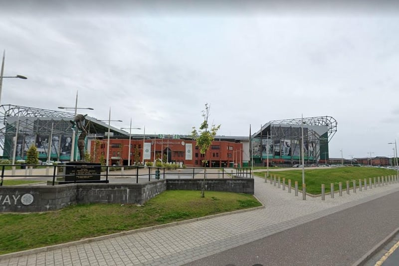
4. Celtic Park - now
Officially opened in 2014, the multi-million pound Celtic Way looks much better than the drab scene of yesteryear - though it did involve the demolition of the Victorian London Road school. Photo: Google Street View