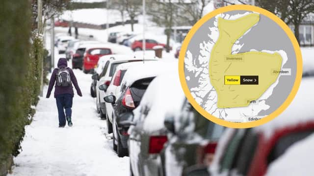
Weather warning: The Met Office issue further yellow warnings of snow and ice across Scotland


As a snow and ice warning remains across the majority of Scotland for today, the Met Office has issued further yellow warnings of snow which will spread into more centralised areas across Scotland nearing the end of the week.
Areas currently affected today by the snowy and icy conditions include Central, Tayside and Fife, Grampian, Highlands, south west Scotland and Lothian Borders and the Strathclyde area.
Advertisement
Hide AdAdvertisement
Hide AdOn Wednesday and Thursday, a yellow warning of snow will affect certain northern and southern areas of Scotland.
However, the Met Office has recently updated its weather warning to now include the central belt in the yellow snow warning from Friday beginning at midnight and remaining in place until 12pm on Sunday afternoon.
Areas affected by the snow include Central, Tayside and Fife, Grampian, Highlands, south west Scotland, Lothian Borders and the Strathclyde area.
Significant disruption from the snowy conditions is expected with potential for blizzard conditions.
Across Scotland, possible travel delays on roads are expected with possible delays or cancellations to rail and air travel and a chance rural communities could be cut off for several days.
There is also a small chance that long interruptions to power supplies and other services, such as gas, water, telephone and mobile phone coverage, may occur.
A Met Office Spokesperson said: “An area of heavy rain and snow over Scotland will slowly move south over the weekend, bringing further snow accumulations, firstly over high ground in the north, but increasingly to low levels through Saturday and into Sunday.
“A further 20 to 30 cm may fall above 200 m, with 5 to 10, perhaps locally 20 cm falling even to low levels as we move into the weekend.
Advertisement
Hide AdAdvertisement
Hide Ad“Strong winds could lead to significant drifting of snow and temporary blizzard conditions.”
Elsewhere in the UK, an amber weather warning for snow came in force across much of South Yorkshire, and parts of Derbyshire, West Yorkshire and Greater Manchester at 3am on Tuesday and will last until 1pm today.
You can view the latest weather warnings on the Met Office's interactive map.