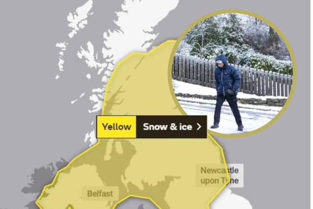
Scotland weather: This is when the yellow weather warning for snow and ice officially ends
The Met Office has said that there is the potential for icy surfaces and some travel disruption in Edinburgh and across the rest of Scotland after an area of rain, sleet and snow moved South on Sunday night.
Dumfries and Galloway, East Lothian, Midlothian Council and Scottish Borders join Edinburgh in the south west of Scotland affected by the yellow weather warning.
Advertisement
Hide AdAdvertisement
Hide AdOther areas across Scotland affected include Strathclyde, Central, Tayside and Fife, Grampian and the Highlands and Eilean Siar.

Areas across England will also be affected.
The Met office has predicted the icy and snowy conditions will end at 10 am this morning.
This news comes as the official Met Office warning has been extended to cover more northern and eastern Scotland. The start time for the weather disruption was also brought forward by 3 hours to 3pm yesterday.
Some roads and railways are likely to be affected with longer journey times by road, bus and train services.
Some injuries from slips and falls on icy surfaces are predicted by the weather forecaster.
There is a probability of some icy patches on some untreated roads, pavements and cycle paths across affected areas.
A Met Office spokesperson said: " A band of rain, sleet and snow followed by wintry showers will move south across western and central parts of Scotland and Northern Ireland on Sunday evening and then into parts of northern England and north Wales early on Monday morning.
"Localised accumulations of 1-3 cm are possible to lower levels but higher accumulations are likely over higher ground. Above 250 metres, accumulations of 5-10 cm are possible. Skies are expected to clear from the north overnight and widespread ice is likely to develop and persist through to Monday morning, especially across central and eastern areas.”
Advertisement
Hide AdAdvertisement
Hide AdA message from the Editor:Thank you for reading this article. We're more reliant on your support than ever as the shift in consumer habits brought about by Coronavirus impacts our advertisers.
If you haven't already, please consider supporting our trusted, fact-checked journalism by taking out a digital subscription.