Scotland weather forecast: White Christmas continues into Boxing Day as Met Office snow weather warning expanded
Rain, sleet and snow fell overnight across Scotland as many of us went to bed with bellies full of Christmas Dinner and mince pies.
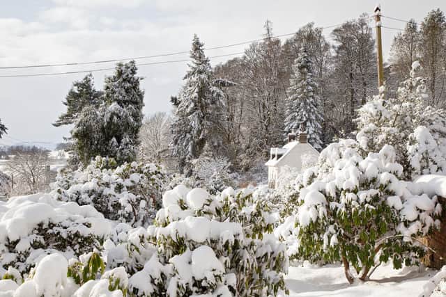
As a result, those waking up across the country may see a covering of snow particularly in higher ground through the southern uplands and for higher ground to the north of the central belt.
Advertisement
Hide AdAdvertisement
Hide AdHowever, it is predicted that by afternoon the chance of snow will ease off.
One of the Met Office’s yellow warnings was expanded to include an area from the Scottish Borders to Derbyshire, as well as further east over Durham and Northumberland, due to the increased chance of snow accumulating over the southern Pennines overnight.
A second yellow warning was in place for a smaller area north of Glasgow and heading north-east across the Forth Valley, with the weather service saying Clackmannanshire, Falkirk, Perth and Kinross, and Stirling were likely to be affected on Sunday.

A Met Office spokesman said: “As an area of rain moves northwards, it looks like turning to snow over parts of northern England, and then southern and central Scotland.

“Accumulations of 2-4 cm of snow are possible above 200 metres and 5-10 cm above 300 metres.
“Coupled with strong winds, gusting to 35 to 45 mph in places, this is likely to lead to some difficult travel conditions across higher Pennine and Cumbrian routes, as well as the Southern Uplands, during the early hours of Sunday.
“Temporary blizzard conditions may be encountered above around 300 or 400 metres elevation. These conditions will probably move into some hillier central parts of Scotland during Sunday morning, while snow turns back to rain further south.”
The Met Office said some “short term” loss of power and other services is possible during the period of the warnings.
Advertisement
Hide AdAdvertisement
Hide AdBoth yellow warnings are expected to end at midday on Sunday.
On Saturday, the service said it had been a white Christmas for parts of the UK as people in Shetland and eastern Scotland woke up to a blanket of snow.
A message from the Editor:
Thank you for reading this article. We're more reliant on your support than ever as the shift in consumer habits brought about by coronavirus impacts our advertisers.
If you haven't already, please consider supporting our trusted, fact-checked journalism by taking out a digital subscription.
Comments
Want to join the conversation? Please or to comment on this article.