Scotland braces for ‘blizzard conditions’ as yet more snow is forecast
It follows travel disruptions earlier this week caused by snow and ice, leading the Met Office to issue several severe weather warnings for the days ahead.
Forecasters explained that cold air from Scandinavia, which is sitting across the north of the UK is coming into contact with warmer, moist air pushing in from the southwest Atlantic. Where these two air masses meet, rain drops turn into snow.
Advertisement
Hide AdAdvertisement
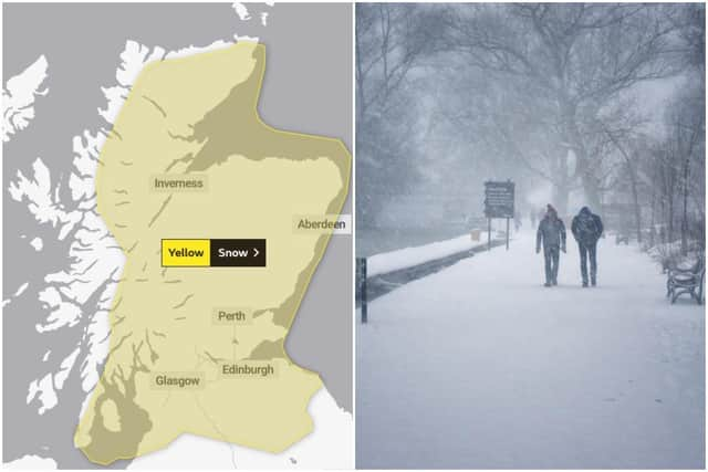
Hide AdMuch of northern and eastern Scotland is currently under a yellow warning for snow on Wednesday and Thursday, as is a significant portion of the Borders.
By Friday, the weather warning will cover almost all of mainland Scotland - and will stay in place until Sunday, February 7.
Met Office Chief Meteorologist, Frank Saunders, said: “There could be continued travel disruption across northern trans-Pennine routes and the higher roads across the Southern Uplands and Grampians.
“Meanwhile, a period of heavy rain overnight into early Wednesday will result in rapid thawing of snow in places, particularly north east England, which may lead to a risk of flooding.”
Met Office Deputy Chief Meteorologist, Mark Sidaway, added: “Into the weekend snow will continue across much of Scotland, and is likely to increasingly fall to low levels before beginning to move south into northern and eastern England.”

“We are likely to see some very large accumulations across higher parts of Scotland especially, with strong winds leading to significant drifting and blizzard conditions at times.”
A message from the Editor:
Thank you for reading this article. We're more reliant on your support than ever as the shift in consumer habits brought about by coronavirus impacts our advertisers.
If you haven't already, please consider supporting our trusted, fact-checked journalism by taking out a digital subscription.
Comments
Want to join the conversation? Please or to comment on this article.