Edinburgh weather: Heavy snow set to fall in Capital and Lothians TODAY as three-day weather warning issued - hour-by-hour
Heavy snow is set to fall in Edinburgh and the Lothians today as expert forecasters bring a three day yellow warning into place.
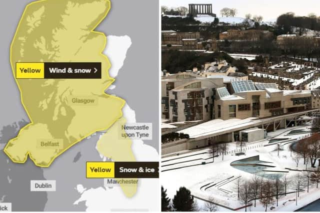
The three-day warning, for wind and snow on Monday and Tuesday and then snow and ice on Wednesday, is in place all day on Monday and comes after Storm Ciara hit the region over the weekend, forcing the partial closure of Edinburgh Waverley and disrupting the tram network.
Advertisement
Hide AdAdvertisement
Hide AdThe white stuff will begin falling as sleet around 8am, according to Met Office officials, and will gain in intensity as the morning goes on.

Heavy snow is expected to begin falling at around 10am and continue until around 5pm.
What the Met Office say to expect:
- Possible travel delays on roads stranding some vehicles and passengers
- Possible delays or cancellations to rail and air travel
- Power cuts may occur and other services, such as mobile phone coverage, may be affected.
- Delays for high-sided vehicles on exposed routes and bridges likely
- Some injuries from slips and falls on icy surfaces
- Icy patches on some untreated roads, pavements and cycle paths.
Here's the hour-by-hour forecast for Monday:
7am: Heavy rain
8am: Sleet
9am: Sleet
10am: Heavy snow
11am: Heavy snow
12pm: Light snow
1pm: Heavy snow
2pm: Heavy snow shower
3pm: Light snow
4pm: Light snow
5pm: Sleet
6pm: Light rain
7pm: Light rain
8pm: Light shower
9pm: Sleet
10pm: Light shower
11pm: Overcast
A spokesperson for the Met Office said: "Frequent and heavy snow showers will affect the region throughout Monday and Tuesday.
"Snow showers will occur especially over high ground, giving slight accumulations of 1 to 3 cm above 150 metres and 5-10 cm above 300 metres.
Advertisement
Hide AdAdvertisement
Hide Ad"Snow will gradually build up and in a few locations, accumulations of over 20 cm are possible by Tuesday evening over the highest routes in Scotland.
"The height of the snow level will vary throughout the period, but it is likely that any snow accumulations at low levels will only be temporary.
"Strong winds, gusting 50-60 mph, will lead to blizzard conditions at times and considerable drifting of lying snow over high ground. Icy surfaces are likely to occur, more especially on Monday night into Tuesday morning.
"Frequent lightning strikes are also possible, perhaps leading to interruptions to power supplies."