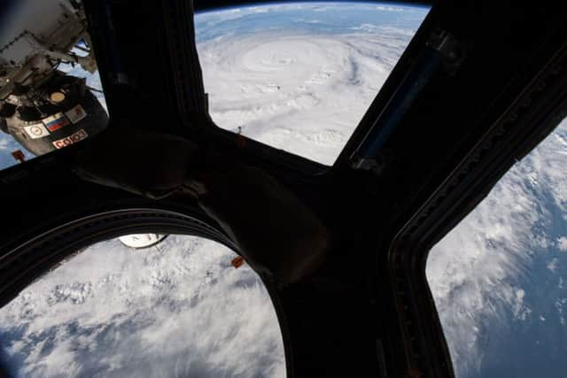
Video: Hurricane Harvey filmed sweeping across Texas from space


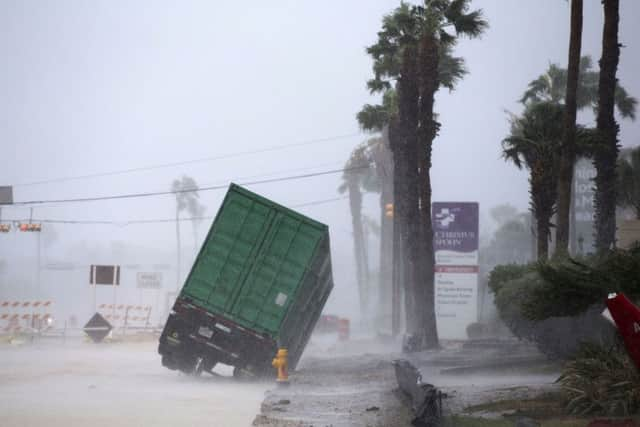
The fiercest hurricane to hit the US in more than a decade made landfall Friday night about 30 miles (48 kilometres) northeast of Corpus Christi as a Category 4 storm with 130 mph (209 kph) winds. It gradually weakened over the next several hours and the National Hurricane Centre said that by 5am Saturday Harvey was downgraded to a Category 1 - still sustaining winds of 90 mph (144 kph). It had already dumped more than 9 inches (228.6 millimetres) of rain in the South Texas city of Victoria and other places.
Forecasts call for as much as 30 inches (.76 meters) of rain to fall by next Wednesday, with some areas getting as much as 40 inches (1 meter), according to the hurricane centre. Meanwhile, the storm surge could bring flooding of 6 to 12 feet (2 to 4 meters) to a coastal area that includes Matagorda Island and Port O’Connor.
Advertisement
Hide AdAdvertisement
Hide AdMore than 200,000 people were without power Saturday, with flash-flood and tornado warnings in place for a broad region that includes Houston to the northeast.
Harvey’s approach sent tens of thousands of residents fleeing inland, hoping to escape the wrath of a menacing storm that threatens not only the coast but a wide swath of Texas that is home to oil refineries, chemical plants and dangerously flood-prone Houston, the nation’s fourth-largest city.
No deaths were immediately confirmed in the hours after Harvey’s arrival, but officials noted emergency crews couldn’t get out in many places due to high winds. Melissa Munguia, deputy emergency management coordinator in Nueces County, which includes Corpus Christi, said early Saturday that it could be hours before crews could fully assess the damage in coastal communities.
Early reports did begin to emerge from Rockport, a coastal city of about 10,000 people that was directly in Harvey’s path when it came ashore. Officials confirmed that the roof of Rockport’s high school had partially caved in and that the community’s historic downtown saw extensive damage.
Rockport City Manager Kevin Carruth told local media outlets that multiple people had been taken to the county’s jail for assessment and treatment after the roof of a senior housing complex collapsed. KIII-TV reported that 10 people were treated there.
Earlier Friday, Rockport Mayor Pro Tem Patrick Rios had offered ominous advice, telling the station that those who chose to stay put rather than evacuate the area “should make some type of preparation to mark their arm with a Sharpie pen,” implying doing so would make it easier for rescuers to identify them.
Harvey came ashore as the fiercest hurricane to hit the US in 13 years and the strongest to strike Texas since 1961’s Hurricane Carla, the most powerful Texas hurricane on record. Based on the atmospheric pressure, Harvey ties for the 18th strongest hurricane on landfall in the US since 1851 and ninth strongest in Texas.
A worst case scenario is that the hurricane could hug the coast for days and stay strong enough to be a tropical storm through Wednesday at least. During this meandering time, the storm will likely dump 2 feet (0.61 meters) to 3 feet (0.91 meters) of rain, often on areas that don’t handle much smaller rainfall amounts well.
Advertisement
Hide AdAdvertisement
Hide AdSometime early next week forecasters said it could go back into the warm Gulf of Mexico waters, which provide fuel, then turn back in for a potential second hit on what may be an already flooded Houston-Galveston area.
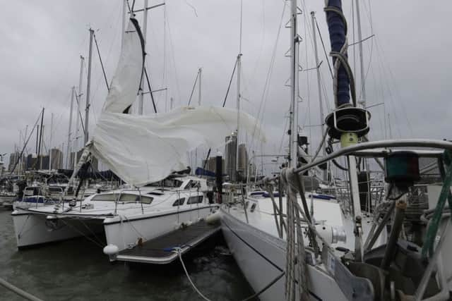
Before the storm arrived, home and business owners raced to nail plywood over windows and fill sandbags.
The last Category 4 storm to hit the US was Hurricane Charley in August 2004 in Florida. Superstorm Sandy, which pummeled New York and New Jersey in 2012, never had the high winds and had lost tropical status by the time it struck. But it was devastating without formally being called a major hurricane.
Harvey is the first significant hurricane to hit Texas since Ike in September 2008 brought winds of 110 mph (177 kph) to the Galveston and Houston areas, inflicting $22 billion in damage.
It’s taking aim at the same vicinity as Carla, which had wind gusts estimated at 175 mph and inflicted more than $300 million in damage. The storm killed 34 people and forced about 250,000 people to evacuate.