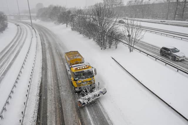
Spring lies ahead after '˜mini beast from the east' blows through


However, it is likely to be only a short cold snap before milder conditions return in time for the vernal equinox on Tuesday – the traditional start of spring.
Before that, the Met Office said a very cold easterly airstream will bring snow.
Advertisement
Hide AdAdvertisement
Hide AdMeteorologist Martin Bowles said the weekend’s weather could be dubbed a “mini beast from the east”.
He said: “We don’t expect anything like the same impact as a result of it, although there will be some snow about.”
A yellow “be aware” severe weather warning has been issued by the agency for much of Scotland away from the south-west and Highlands.
It will be in force from 5pm on Saturday to 10am on Sunday with up to 7cm of snow on higher ground and up to 3cm at lower levels.
A Met Office spokeswoman said: “Snow showers will turn heavier later on Saturday, overnight and into Sunday morning.
“Icy patches will form on untreated surfaces, pavements and cycle paths.
“Some roads and railways are likely to be affected with longer journey times.”
But up to 15cm of snow is forecast for areas of England including around Nottingham and Leeds, where an amber “be prepared” warning will be in force.
Advertisement
Hide AdAdvertisement
Hide AdThe Met Office warned of temporary blizzard conditions and drifting of snow, travel delays and the threat of vehicles being stranded.
A yellow warning for ice in Scotland away from the far west and north has been issued for midnight to 10am on Monday.
The Met Office said: “Ice on roads, pavements and cycle paths is likely.
“This increases the risk of accidents, as well as injuries due to falls.
“After a very cold day on Sunday, temperatures are likely to fall well below freezing across much of the country into the start of Monday.
“This will lead to any melted snow re-freezing, whilst coasts exposed to the northeasterly wind will continue to see further wintry showers at times, these falling onto subzero surfaces.”
However, milder conditions are expected to follow, with 8 to 9C in Edinburgh and Glasgow by Tuesday and 9 to 10C by Thursday.
The Met Office said: “The weather will remain cold for Monday, but the risk of snow diminishes. As we head further into the week we begin to see a return to conditions more typical for mid-March.”