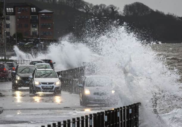
Scotland's weather: Warnings as heavy rain floods roads


Several roads were closed and trains cancelled by flooding, with snow hampering driving over the Drumochter pass on the A9 between Perth and Inverness.
Two Met Office yellow - “be aware” - severe weather warnings have been issued, including for winds up to 65mph.
Advertisement
Hide AdAdvertisement
Hide AdHowever, the impact of the next storm - named today as Imogen - is expected to be limited to southern England and Wales when it arrives tomorrow with winds of up to 80mph.
Roads shut by floodwater included the A8 in Greenock, one lane of the M9 near Stirling, and sliproads from the A82 to Renton in West Dunbartonshire.
A car overturned on the A92 south of the Tay Road Bridge, with the crossing shut to all traffic except cars and single-decker buses amid winds of more than 60mph.
There were also vehicle restrictions on the Forth Road Bridge, where winds gusted around 55mph.
Strong winds also affected the Clackmannanshire, Erskine and Skye bridges, and the A1 east of Haddington in East Lothian.
Traffic was very slow on the M8 through Glasgow because of strong winds and rain.
Heavy rain flooded railway tracks at Larbert, causing train cancellations and delays of up to half an hour on routes between Edinburgh, Glasgow and Alloa, Dunblane, Aberdeen and Inverness.
CalMac halted sailings between Lochranza on Arran and Claonaig on Kintyre, and between Mull and Iona, with 13 of its 24 other west coast routes on amber alert for possible disruption.
Advertisement
Hide AdAdvertisement
Hide AdThe Scottish Environmental Protection Agency has four flood warnings in force for rivers in Perthshire and west of Inverness.
A Met Office yellow warning for rain across central and western Scotland lasts until 6am tomorrow.
Its spokeswoman said: “Showers or longer spells of rain will affect much of southern and western Scotland during Sunday and into Sunday night.
“The rain will be accompanied by gale force west to south-westerly winds during daylight Sunday, with gusts of 45-55mph quite widely, perhaps 60-65mph over exposed coasts and bridges.
“Please be aware of some difficult driving conditions due to standing water and spray, and perhaps localised surface water flooding.
“15-25mm of rain is expected quite widely within the warning area, with perhaps 30-40mm over higher ground in the west.”
The second yellow warning, for ice, will be in force from 9pm until 9am tomorrow for the eastern Highlands and north east.
Higher roads could be affected by more snow, such as on the A9 around Drumochter and north from Slochd summit.
Advertisement
Hide AdAdvertisement
Hide AdThe Met Office spokeswoman said: “Icy stretches are expected to form on untreated surfaces later on Sunday evening and overnight into Monday morning.
“Some wintry showers are still possible overnight, mainly in the west of the warning area, and could give a few centimetres of snow, mainly above 300-400m, while adding to the ice risk at lower levels.
“Please be aware of these wintry hazards and the potential for some difficult driving conditions overnight and into the Monday morning rush hour.”
The agency has issued an amber - “be prepared” - warning for Storm Imogen for south west England and the entire south coast.
It forecasts winds widely gusting to 60-70mph, and to 80mph in exposed coastal areas in the south west with very large waves.
These could cause damage to buildings and power cuts.
A wider yellow warning covers southern England and south Wales.