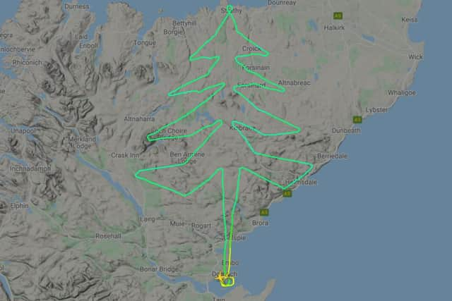
Mystery pilot uses plane to draw Christmas tree on flight radar map
A pilot has used a publicly-available flight map online to get into the festive spirit, using an aeroplane to draw a Christmas tree over the Highlands.


According to flight radar maps, the mystery pilot took off from Dornoch on Tuesday, shortly after 12pm and headed northward.
Forming the tree trunk, the pilot then headed west over Dalnessie before turning back east towards Ben Armine Lodge to draw the bottom rung of the tree.
Advertisement
Hide AdAdvertisement
Hide AdAfter a series of manoeuvres which mapped out the left side of the tree, the plane then peaked up at the northern edge of the Scottish mainland, above Strathy.
The pilot then headed down to draw the right-hand side of the tree, landing at Dornoch once more, arriving at around 1.48pm.