Artemis rocket launch: British team using AI to find best place to walk on Moon
Using new techniques they have developed, the scientists are mapping the lunar surface – in three dimensions – at five times the level of detail than Nasa’s existing methods.
This will enable the astronauts involved in the Artemis mission to determine where best to land their craft and help them to navigate the Moon much more easily than Neil Armstrong and the other space pioneers of the Apollo missions, when mankind first visited half a century ago.
Advertisement
Hide AdAdvertisement
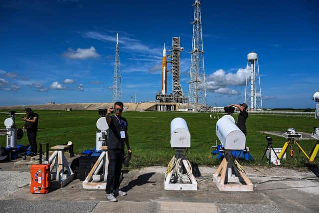
Hide AdThe Artemis mission is due to kick off this evening, UK time, after engine problems postponed the original launch planned for Monday.

The first phase of the programme will take an un-crewed space ship into orbit around the Moon to test the systems work. The human touchdown that the mapping is for will represent the third phase of the mission and is scheduled for 2025.
The unprecedented detail of these maps, which are able to produce a “super high resolution” 3D model of 12.5cm (or pixel size of 12.5cm by 12.5cm), will help the astronauts to avoid rocks, bumps, craters and quicksand when they land and to work out the best path for them to take as they travel around the surface.
It will also help them to determine where best to go to pick up rock samples that can give invaluable clues about the geology of the Moon, which has remained largely unchanged for billions of years and which could, therefore, provide key lessons about the early conditions on Earth.
When landing on and navigating the Moon, there are three kinds of terrain that astronauts really want to avoid. These are rocks, craters and regolith – a quicksand like-layer on the surface of the Moon that includes dust, broken rocks, and other materials, according to project leader Professor Jan-Peter Muller, of the UCL Mullard Space Science Laboratory.
“The Moon is much rockier than the Earth,” he said. “And while there are less than 100 identified craters on Earth there are millions and millions of craters, of just a few metres in size, on the Moon – and they are places that you don’t want to go.
“Nor do you want to go to places with thick regolith. They [Nasa] were very worried about that. They were very worried that when the spacecraft lands it would essentially sink into the lunar soil and, like quicksand, swallow up the astronauts. That’s much trickier to work out.
“Better quality maps and models of the moon’s surface are important to minimise risks and maximise the safety of astronauts. Our techniques, developed over decades, provide the most accurate images and models currently possible. These can help inform decisions about landing sites as well as navigation routes for rovers or manned vehicles.”
Advertisement
Hide AdAdvertisement
Hide AdAll of the 13 proposed landing sites, including those in the von Kármán crater, are around the lunar south pole, where water-ice is believed to have collected in permanently shadowed areas over billions of years. The team are now in the process of producing maps for these sites to help Nasa decide where to land.
Comments
Want to join the conversation? Please or to comment on this article.