Satellite help to preserve Scottish historic sites from climate change


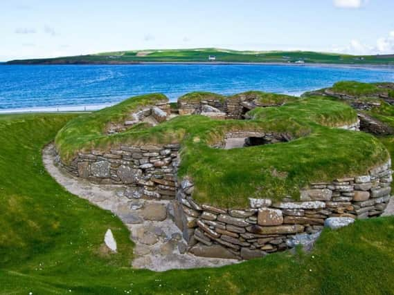
Neolithic village Skara Brae on Orkney is one of the sites involved in the pilot project, launched in partnership with the European Space Agency (ESA).
The World Heritage Site is vulnerable to climate change-related coastal erosion and radar data from the ESA's Sentinel satellite will be used to measure terrain movement.
Advertisement
Hide AdAdvertisement
Hide AdThe path to the site is currently expected to entirely erode away by 2050 unless further action is taken.
Mavisbank Policies, the area of designed landscape laid out in the early 18th century around Mavisbank House near Loanhead, Midlothian, is also part of the project.
It has suffered from landslips and the ground instability can worsen following changes to rainfall patterns.
The project will examine how satellite data can be used to monitor and manage the impacts of coastal erosion and ground movement.
Culture Secretary Fiona Hyslop opened the project launch event at the Engine Shed in Stirling, organised by Historic Environment Scotland (HES), remote monitoring specialist Moniteye and ESA Business Applications and ESA Space Solutions.
Ms Hyslop said: "Historic Environment Scotland supports the Scottish Government in delivering our ambitious climate change targets, and is committed to identifying new ways that conservation can be maintained at its sites.
"The satellite data used in this partnership with the European Space Agency is a fascinating example of how space technology can help preserve, monitor and manage change at our historic sites."
HES climate change manager Mairi Davis added: "We're delighted to launch this exciting new project which will take a new and innovative approach to understanding and managing the climate change risk to Scotland's historic sites."
