Remembering Glasgow's floods of 2002


With some of the worst Scottish summer weather on record, residents in the East End of Glasgow have weathered even worse than the current rainstorms which have swept the nation, with severe flooding in the 1980s, 1990s and 2000s.
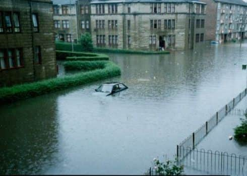
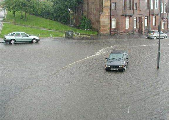
The night of Tuesday 30 July 2002 brought a deluge of rainfall to the urban areas of Shettleston and Greenfield of the Clydeside city, which saw whole cars submerged, houses flooded and the antiquated Victorian drainage system struggle to cope with the vast volume of water.
Advertisement
Hide AdAdvertisement
Hide AdThe torrent engulfed more than 200 homes and railway stations and tunnels, causing major disruption to trains and millions of pounds of damage. Clean-up crews were kept busy at the start of August, with a total of approximately 1500 residents directly affected by the floods and nearly 500 homes affected in total.
Excessive rainfall, caused by a Europe-wide passage of low-pressure weather systems which dragged humid air from the Mediterranean to Northern Europe, was to blame for Glasgow’s suffering. Exacerbating the problem was the geographical intersection of the two worst-affected districts at the foot of a natural valley, which was perfectly-placed to pool excess water.
After quickly overpowering the sewer systems in the area, the water flooded down Cockenzie Street, almost forming a river of its own.
The inability of the existing infrastructure to cope, coupled with the built-up and industrialised landscape of Glasgow’s East End, led to water run-off delivering floodwater to previously-untouched areas.
Dr Doug Bertram of the Department of Civil and Environmental Engineering at the University of Strathclyde said the 2002 floods were a showcase of the unique challenges that urban flooding brings.
He said: “Up to that point, most large-scale flooding events in Scotland were river-based. Traditionally, upland slopes would see water gather in water courses where they would be transported down to the sea. Rivers would burst their banks if the water course wasn’t large enough to accommodate the volume of water.
“Our traditional response to this was to build concrete structures, but one of the key outputs of the 2002 floods was the realisation that the structural measures we put in place to manage drainage weren’t always the optimum solution.”
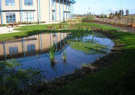
With approximately 70 to 80 per cent of water returned to the environment via surface run-off in urban areas, Bertram highlights the importance of natural flood management as the shared responsibility of Scottish Water, the Scottish Environment Protection Agency (SEPA), local government and affected communities as urban and river flooding has occurred throughout Scotland during the winter of 2015.
Advertisement
Hide AdAdvertisement
Hide AdThe management of water run-off and the shift back to natural methods of evapotranspiration - where water is absorbed back into our environment via plants and absorption into the soil - brings challenges in many of Scotland’s urbanised or brownfield developments.
During the 2002 floods, Glasgow’s Queen Street railway station was shut after fears of a landslide, while the West Coast Main Line between the capital and Glasgow was suspended. The subway system was also affected, with parts of the Argyle Line temporarily flooded.
Nine years later, the £53m Glasgow Flood Prevention Scheme was inaugurated to stem the overflow of the White Cart River and protect the 1750 homes and businesses that line the river, protecting the south of Glasgow and creating marshy natural habitats for animals to exploit.
Despite this measure, the city has continued to be intermittently affected by flooding throughout the last decade.