Record islet trip showed Rockall’s true size


Nick Hancock, from Ratho, carried out a series of tests during his stint on Rockall – 260 miles west of the main Outer Hebrides – and found the extinct volcano to be 33.5 inches shorter than previously thought. Mr Hancock’s data also confirmed that the rock in the Atlantic is in exactly the same place as recorded in 1977.
During his occupation in June and July, the chartered surveyor installed a fixed permanent survey marker on the summit plateau of the rock.
Advertisement
Hide AdAdvertisement
Hide AdHe carried out 24-hour data-collection sessions, connecting to satellites and Ordnance Survey (OS) radio stations. The aim was to update the current United Kingdom Hydrographical Office records relating to the position and height of Rockall collated in 1977. The height was previously estimated about 18 metres above sea level by the Royal Geographical Society in its first map of Rockall.
But now, using Mr Hancock’s data, it had been registered as 17.15m above sea level – 85cm lower than previously thought.
During his stay on Rockall, Mr Hancock passed the 40-day solo occupation record set in 1985 by the SAS veteran Tom McClean. And he beat the 42-day record set by Greenpeace campaigners in 1997.
But a severe storm in the early hours of July 2 forced the adventurer to end his planned 60-day stay early.
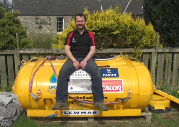
The 39-year-old lived in a converted water tank powered by a small wind turbine and solar panels. He said he was pleased that his stay – which also raised funds for a veterans’ charity – would leave a legacy greater than just setting a record.
Mr Hancock said: “I had hoped that my survey results might significantly relocate Rockall, but being able to finally establish the true height of the rock means that my time spent there has even greater long-term significance than just breaking the previous occupation records and raising funds for Help for Heroes.”
Data was also gathered from OS stations in the Faroe Islands, Northern Ireland and Iceland to plot Rockall’s size.
Mark Greaves, OS satellite positioning expert, said: “Nick’s occupation of Rockall for such a long time is a fantastic achievement and Ordnance Survey was happy to be involved with advice and data processing facilities.
“The satellite positioning data that Nick recorded was of high quality and it enabled the island’s position to be determined to just a few centimetres.”