Neglected 'Maggie's Bridge' mars potential of Scotland's forgotten Monkland Canal - Alastair Dalton

While the Union and Forth & Clyde canals have been rescued from dereliction with their new Falkirk Wheel and Kelpies landmarks becoming major visitor attractions, the Monkland Canal has faded into a little known relic of the Industrial Revolution which played a major part in powering the rise of Glasgow.
My first memories of the city in the 1970s included wondering why the newly-built M8 was known as the Monkland Motorway, not realising it had been built on top of the by-then redundant canal, which linked Glasgow with the hugely productive Lanarkshire coalfields.
Advertisement
Hide AdAdvertisement
Hide AdIt was partly designed by James Watt and opened in stages from 1771, going on to become Scotland’s most lucrative canal, its toll income almost four times its costs.
But now, 70 years after its closure in 1952, while the 12-mile canal is largely hidden it still plays a key role in the Scottish Canals network, feeding the Forth & Clyde Canal with water via pipes under the motorway.
The Monkland Canal in turn is fed by Hillend Reservoir, once the largest created body of water in the world and one of the most attractive views from the Glasgow-Airdrie-Edinburgh rail line.
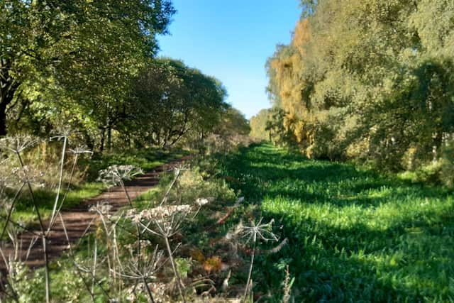
But there is a surprising amount still visible, and not just the fragment beside the Summerlee Museum of Scottish Industrial Life in Coatbridge or the section through the town’s Drumpellier Country Park.
I was amazed to come across the rather less known two-mile stretch at its eastern end, at Calderbank, just north of the newest section of the M8.

My immediate thought was that the route’s potential was not being realised – with its recently-resurfaced towpath, it appeared the epitome of the off-road network the Scottish Government.
The budget to boost walking, cycling and wheeling is being significantly increased, overseen by a dedicated active travel minister, the Scottish Greens co-leader Patrick Harvie.
But while I found the waterway a beautiful haven amidst the North Lanarkshire urban sprawl, it was also marred by being poorly signposted, with direction signs obliterated by graffiti.
Advertisement
Hide AdAdvertisement
Hide AdWorse, a footbridge over the canal as part of a circular walk in Calderbank has been closed for the best part of a decade after falling into a state of disrepair.
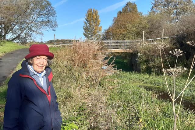
It is known as “Maggie’s Bridge” in memory of a villager who campaigned for the crossing to be saved in the 1850s after its use for transporting coal ended.
A group of locals are carrying on Maggie’s fight, 170 years on, to secure the bridge’s future.
As Woodhall, Faskine and Palacecraig Conservation Group trustee Ann Glen put it: “Here was a woman campaigning at a time when women did not have much say, and she was able to swing it – it was an early example of female empowerment.”
She said the bridge was a “shocking example of sheer neglect” with the situation “highly inconvenient and annoying”.
A Scottish Canals response has been requested.
Comments
Want to join the conversation? Please or to comment on this article.