New app rates the ‘walkability’ of Scottish streets
This article contains affiliate links. We may earn a small commission on items purchased through this article, but that does not affect our editorial judgement.


Walkonomics – a combination of walking and ergonomics – has used hundreds of sources of information to calculate the attractiveness of more than 20,000 stretches of Glasgow’s streets.
The free service already covers 600,000 streets in England, with roads in Edinburgh and other Scottish cities to follow.
Advertisement
Hide AdAdvertisement
Hide AdThe app enables tourists to check the ambience of streets around their hotel, and provides home buyers with a sense of a neighbourhood when looking for properties – as well as encouraging walking.
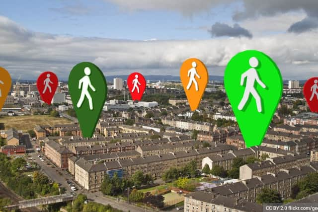
Walkonomics uses eight criteria to assess the “pedestrian friendliness” of a street, including road safety, ease of crossing and navigation and crime levels.
The steepness of streets – as much a factor in parts of Glasgow as hilly Edinburgh – is also taken into account, along with the extent of tree cover, and number of shops and pedestrian crossings. Missing street signs, vandalism, graffiti and litter marks a street down, along with heavy or fast traffic.
Information has been taken from 400 sources, in collaboration with the city council’s Future City Glasgow data-sharing initiative. This is being supplemented by ratings posted by walkers.
Some of the most “walkable” streets include the Scottish Exhibition and Conference Centre precinct, and the traffic-free section of Sauchiehall Street in the city centre. The worst-rated include Castle Street, where it crosses under the M8 north of Glasgow Royal Infirmary, for its high traffic levels and few crossing points.
Nottinghamshire-based Walkonomics founder Adam Davies, who has also covered Manhattan, San Francisco and Toronto, said he hoped the app would also help revitalise less attractive districts.
He said: “If you design streets for pedestrians, it will boost retail sales, improve health and reduce crime.
“Research has shown that taking a more pleasant route means you arrive less stressed than if you have walked through traffic-filled streets.”
Advertisement
Hide AdAdvertisement
Hide AdPedestrian campaign group Living Streets welcomed the project, but said it must be comprehensive.
Spokesman Chris Thompson said: “I am sure a tool such as this will play a vital role in painting a clearer picture of our streets.
“However, it is important to address the fact that barriers can often not be seen or explained via a virtual app, such as pavement parking, traffic and street clutter, which can impact on the walkability of our streets.”
Martin Parretti, of Walkit.com, a walking route planner, said: “The physical environment through which a walk will take you is an important factor influencing many people’s decisions about whether to walk or not.”