Culloden: Battle map review as new position of Jacobite soldiers discovered
A laser survey of the land, combined with archival map research, has found a new location for the Jacobite left flank, which was deployed at a more westerly point than previously thought.
It comes after Historic Environment Scotland (HES) uncovered new evidence for the location of Culloden Parks, the designed landscape around Culloden House, which was thought thought to have been lost through changes in land use.
Advertisement
Hide AdAdvertisement
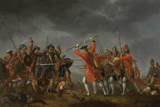
Hide AdThe house played a key role in the conflict as a headquarters for Bonnie Prince Charlie and his commanders in the days leading up to the battle with with Jacobites known to have used the southern end of Culloden Parks as their left flank when they deployed on April 16, 1746.

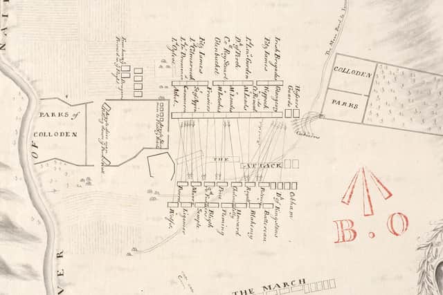
The investigation by HES found new evidence that shows Culloden Park was situated further to the west of the traditional battlefield site than previously thought, giving the Jacobite left flank the new position.
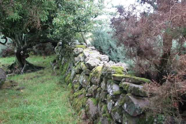
A significant amount of the boundary walls of the Parks is also now known to survive.
Kevin Munro, senior designations officer at HES who conducted the research, said the findings had a significant bearing on current understanding of the battlefield landscape and the battle itself.

Mr Munro said: “The Battle of Culloden is one of the most documented and studied conflicts in Scotland’s history, so to unearth new information that will further enhance our understanding of this significant battle is very gratifying.
“As part of our role in maintaining the Inventory of Historic Battlefields, we routinely review and assess different sources of information that can continue to help shape our understanding of these significant pieces of Scotland’s historic environment.
“This clear evidence for the survival of Culloden Parks shows us that the story of the Battle of Culloden is still unfolding along with our understanding of the historic landscape. This research will further enhance our knowledge of the pivotal events that took place on 16 April 1746.”
Mr Munro said the battlefield inventory would now be reviewed as a result of the findings.
Advertisement
Hide AdAdvertisement
Hide AdHe added: “If we know the Jacobite line moves, we have to consider where the government line would sit in relation to that.
"We know that before the final Jacobite charge, the Jacobite line adjusts but we don’t necessarily know where it ends up. That is one of the next steps we will be considering.”
In the 276 years since the battle, the landscape of Culloden has been significantly altered through agriculture, development, and changes in land use.
Many elements of the landscape that were recorded in the 1740s were believed to have been lost to these changes, including Culloden Parks. While a number of features have been identified or confirmed through historical and archaeological research, much of the battlefield has remained unclear.
The discovery of the location of Culloden Parks in the modern landscape was made by cross-referencing contemporary 18th century maps alongside much more precisely detailed modern mapping.
HES also used modern technology in the form of airborne laser scanning, known as LIDAR, which records the landscape in 3D. This data can show subtle landscape features more prominently than is often seen on the ground
Comments
Want to join the conversation? Please or to comment on this article.