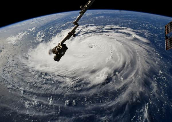
Hurricane Florence: Residents flee as Category 4 storm heads for US coast


Hurricane Florence’s top winds dipped to 130mph on yesterday, but it remains a Category 4 storm and is expected to approach Category 5 status as it slows and strengthens over warm water off the coast of North and South Carolina.
The centre of the storm is forecast to meander tomorrow, Friday and Saturday over a stretch of coastline saturated by rising seas, inundating several states with rainfall and triggering life-threatening floods.
Advertisement
Hide AdAdvertisement
Hide Ad“Please be prepared, be careful and be SAFE!” US president Donald Trump tweeted.
Mandatory evacuations are under way for parts of three east coast states, and the mayor of Washington DC declared a state of emergency as the US capital prepares for heavy rain and flooding.
South Carolina’s governor ordered the evacuation of the state’s entire coastline yesterday and predicted that a million people would flee as major roads reverse directions.
Virginia’s governor ordered a mandatory evacuation for some residents of low-lying coastal areas, while some coastal counties in North Carolina have done the same.
North Carolina governor Roy Cooper said his state is “in the bullseye” and urged people to “get ready now”.
The centre of that bullseye may be Camp Lejeune, a sprawling Marine Corps training base. Forecast predict 20 inches of rain or more falling there, part of a wide stretch of rainfall that could see ten inches or more over much of Virginia and drench the nation’s capital. Some isolated areas could get 30 inches, forecasters said.
Florence could hit the Carolinas harder than any hurricane since Hazel packed 130mph winds in 1954.
That Category 4 storm destroyed 15,000 buildings and killed 19 people in North Carolina. In the six decades since then, many thousands of people have moved to the coast.
Advertisement
Hide AdAdvertisement
Hide AdThe storm’s first effects were already apparent on barrier islands as dangerous rip currents hit beaches and seawater flowed over a state highway – the harbinger of a storm surge that could wipe out dunes and submerge entire communities. Watches are already in effect for a storm surge that could reach up to 12ft at high tide on a stretch from Cape Fear to Cape Lookout in North Carolina, forecasters said.
A hurricane watch was in effect for Edisto Beach, South Carolina, to Virginia’s southern border, with the first hurricane-force winds arriving late tomorrow.
If Florence slows to a crawl just off the coast, it could bring torrential rain all the way into the Appalachian mountains and as far away as West Virginia, causing flash floods, mudslides and other dangerous conditions in places that do not usually get much tropical weather.
Craig Fugate, former director of the US Federal Emergency Management Agency, said: “This is going to produce heavy rainfall, and it may not move very fast. The threat will be inland, so I’m afraid, based on my experience at Fema, that the public is probably not as prepared as everybody would like.”
National Hurricane Centre director Ken Graham warned that Florence is expected to linger once onshore, downing trees, knocking out electricity and causing widespread flooding.
Mr Graham warned that the “staggering” size of the storm means its impacts will be felt far and wide.
The storm’s potential path also includes half a dozen nuclear power plants, pits holding coal-ash and other industrial waste, and numerous pig farms that store animal waste in massive open-air lagoons.