Weather: Wettest month ever as storms hit again


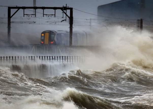
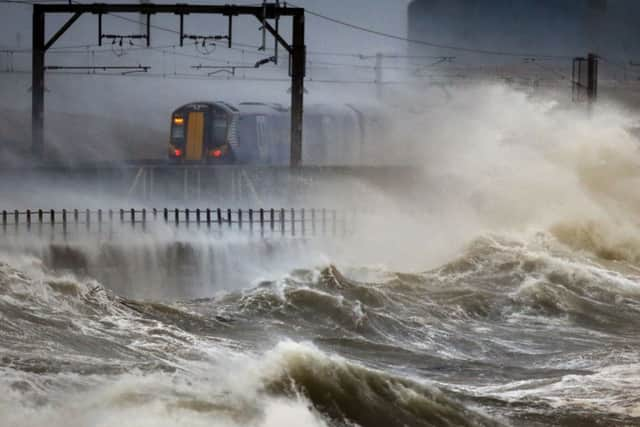
The figures were released as yet more wet weather, strong winds and high tides battered Scotland and the rest of the UK, flooding towns, bringing travel misery and leaving homes without power.
Dr Richard Dixon, director of Friends of the Earth Scotland, said the record-breaking wet weather was a direct consequence of climate change.
Advertisement
Hide AdAdvertisement
Hide Ad“We are seeing much wetter winters, particularly in the west. If you are living in Glasgow, it is probably about twice as wet as it was 50 years ago,” he said. “This is due to the shifting pattern of the jet stream. The Arctic ice is melting – which means there is more open water which means it is warmer – and it is this warmer air which has shifted the jet stream.


“It used to bring in weather from the Arctic, which was cold but not so damp, but now it brings in weather coming off the Atlantic, which is wetter.”
Lang Banks, WWF Scotland director, said wetter winters were set to become more common in Scotland. “Of great concern too is the threat of rain falling in more intense bursts, which has the ability to cause structural damage as well as flooding,” he said.
Yesterday’s tidal surge combined with rain and gale-force winds caused flooding in several parts of the country, with the west coast being hardest hit.
Roads were closed, rail services disrupted and many ferry crossings delayed or cancelled.
Ardrossan, in Ayrshire, and Dumbarton had among the most extreme weather, with waves crashing over esplanades, damaging cars and engulfing roads.
In Dumbarton, the River Leven over-topped its banks, flooding pathways in the town.
Sea water was blown across the main road through the seaside town of Largs, while the fishing port of Kirkcudbright was hit by the worst floods for 30 years as up to 4ft of water flooded the harbour area, hitting homes and business premises.
Advertisement
Hide AdAdvertisement
Hide AdPolice in Dumfries issued a warning after a man was seen swimming in the River Nith while it was in full spate. He was later traced and found to be safe and well. Four sea swimmers were criticised after jumping into Cellardyke harbour in Fife, hours after the Met Office issued warnings of severe weather.
By yesterday afternoon, the Scottish Environment Protection Agency had 38 flood warnings and 14 flood alerts in place.
The stormy conditions caused travel disruption, with the A78 in Ayrshire closed in both directions between Stevenston and Kilwinning, and Skelmorlie and Largs.
In Dumfries and Galloway, the Kelton to Glencaple road was blocked, and there was flooding on the A747 between Glenluce and Port William, and at Carsethorn, Powfoot and Newbie.
The area around Annan harbour was flooded, as were properties in a number of other towns and villages including the Isle of Whithorn, Portpatrick, Garlieston, Carsethorn, Powfoot and Port William.
Nearly 400 homes in the area were without power last night due to the bad weather.
In Edinburgh, high winds forced the closure of Edinburgh Castle and West Princes Street Gardens. Masonry from a chimney stack fell from a building in Marshall Street in the city, but no-one was hurt.
ScotRail services suffered major disruption, particularly on lines to and from Clyde Coast resorts such as Helensburgh, Largs and Ardrossan, while there were delays of up to an hour on Virgin services between Carlisle and Lockerbie.
Advertisement
Hide AdAdvertisement
Hide AdSome trains from Edinburgh to Helensburgh were forced to terminate at Dumbarton Central, and services from Glasgow Central to Ardrossan Harbour had to stop at Kilwinning.
The Forth and Tay Bridges were closed to high-sided vehicles and speed restrictions were imposed on other vehicles.
Flooding at high tide caused chaos across the Western Isles, including the closure of roads in Stornoway town centre. Several causeways were forced to shut, particularly in the Uists, as water washed over the roadways linking the islands.
The Skye Bridge was closed to high vehicles, as were Kessock Bridge in Inverness and Dornoch Bridge.
With winds of up to 60 knots in areas, ferry services were severely affected.
The funeral of Flora MacNeill, 95, the oldest woman on Colonsay, had to be postponed after the cancellation of the CalMac ferry from Oban meant mourners could not reach the island.
Registrar Kevin Byrne said the family had decided to postpone the service until tomorrow.
A CalMac spokesman said: “We have been advised that there will be periods of severe weather hitting Scotland over the coming days and as a result our services may experience cancellations and/or disruptions.
Advertisement
Hide AdAdvertisement
Hide Ad“Due to the impact of this weather, it is likely our timetables and sailings will change at very short notice as we endeavour to maintain lifeline services.”
P&O Ferries yesterday suspended sailings from Cairnryan to Larne in Northern Ireland.
Environment minister Paul Wheelhouse visited the police communications centre in Govan, Glasgow.
He said: “I have seen from Police Scotland cameras that emergency responders are working extremely hard in locations around the country to provide a co-ordinated response to these difficult conditions.”
The minister said there had been high tide levels in Fort William and Oban but sea defences had not been breached. “We have, however, had some flooding in Stornoway and that’s something that wasn’t necessarily predicted,” he said.
He added: “We know already there’s another low pressure system hitting us on Sunday, but we don’t know yet how severe it will be.
“There’s no particular signal that it’s going to be a particularly bad one but because of the degree of saturation of the ground that we have at the moment, any rainfall of significance can trigger local flooding.”
Dan Williams: It’s no freak – this happens when two air systems collide
Advertisement
Hide AdAdvertisement
Hide AdAlthough it has been stormy, this was not a freak weather front. There has been a run of very stormy weather recently – we have had many storms of this magnitude before. Last November was very stormy, for example.
There is no evidence that we are experiencing a particularly unusual active period of stormy weather.
And you can lay the blame for the present weather at the clash of two air masses.
The first thing to say is that it is winter, when we would expect some stormy weather. This type of wet and windy weather occurs when there is a big difference between the cold air coming from the Arctic and the warm air from the Tropics, which creates a front.
It’s the degrees of difference between the warm and cold air which adds vigour and pace to the storm.
At the moment, the UK is at the latitude where these two air masses meet. This weather is being brought in by the jet stream, a narrow band of fast-moving air.
The jet stream guides the low air pressure system from the Atlantic, and there are currently a lot of storm tracks coming in north of the UK. The strongest winds are on the southern flank of the storm, which is sitting above the north side of the UK and battering this part of the country.
The jet stream is pretty strong just now and that can add power to the storm as well.
Advertisement
Hide AdAdvertisement
Hide AdAlso, the winters for the past few years have been much colder and calmer than this, which can make people feel that this is unusual weather – but it’s not.
However, in the weeks ahead, there are some signals emerging which suggest the weather may undergo a change later this month, allowing colder conditions to become increasingly likely.
This would increase the risk of some wintry conditions developing during the second half of January.
A change to a colder weather type would also increase the potential for more settled conditions, leaving a lower risk of wet and windy spells than has recently been the case.
SEE ALSO