Scotland's weather: Snow falls around country


Orkney’s neolithic settlement at Skara Brae was closed to visitors and motorists attempting to drive the notoriously steep Bealach na Ba road in Wester Ross, part of the scenic North Coast 500 route, were being turned back because of treacherous conditions.

Northern parts of Scotland were expected to be worst hit, with drivers being warned to take extra care.
Advertisement
Hide AdAdvertisement
Hide Ad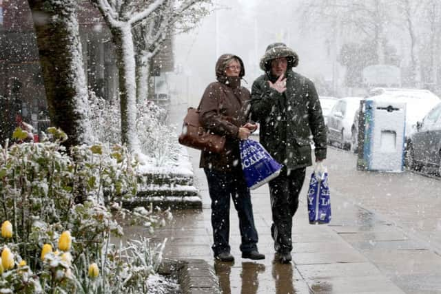
Yellow severe weather warning remain in place for most of the north and some eastern parts until Tuesday morning.
Forecasters said hail, sleet and snow showers were likely to become frequent overnight and early tomorrow.
As much as 5cm of snow was predicted to fall on hills and mountains, while 2cm could accumulate lower down.
They warned travellers to prepare for disruption, with some transport routes likely to affected and journeys taking longer than usual.
Met Office spokesman Grahame Madge said the air moving over the UK from the Arctic would bring large clouds that could result in hailstorms, thunder and lightning and sleet and snow flurries.
“As we go over the next 36 hours those wintry showers will become quite frequent,” he said.
“There’s a possibility of wintry showers just about anywhere in the UK tomorrow but more likely is that people anywhere, really, could see hail.”
Mr Madge said: “In the south, it’s possible the people could see sleety rain or hail for some time but we’re not likely to see any accumulation or settling.
Advertisement
Hide AdAdvertisement
Hide Ad“The more at risk areas for seeing snow are obviously the northern hills and we could possibly see some settling as far south as places like the the higher tops on the North Yorks Moors.
“But, generally, what we’ll see in those very showery conditions is that when it starts to rain, it’ll drop the temperature maybe enough to trigger the development of sleet or even the odd snow shower for a time.”
Mr Madge said the colder weather will also bring plummeting temperatures at night.
He said: “By day, the temperatures won’t be too bad. Really, it’s the night time temperatures that are going to be quite cold. We will see widespread frosts, possibly anywhere, particularly in inland areas.
“These could be quite sharp in places so, obviously, there’s an additional warning to gardeners and horticulturalists.”
Mr Madge said late April snow was not unusual. He said: “It’s possibly created a bit of a surprise for people because we’ve had such a mild March.
“I think it was the 5th mildest March in the record going back to 1910.
“So, I think the fact we’ve got cold weather in combination with a warm March is probably a bit of a shock for people.
“This is a sudden, brief interlude but it’s not unusual.”
The Met Office is expecting the weather to warm-up towards the end of the week.