Walk of the week: East Lomond


The readily accessible Lomond Hills Regional Park dominates the centre of Fife. Seen from miles around, on the northern flanks lie two very clearly identifiable landmarks also known as the Paps of Fife; the twin volcanic peaks of 434m/1,424ft East Lomond, also known as Falkland Hill, and 522m/1,713ft West Lomond, the highest point in Fife. By contrast, the south-eastern flanks are gentler, falling away to rolling moorland terrain and a number of reservoirs close to Glenrothes. The Lomond Hills share the same name and meaning (beacon hill, from the Gaelic laomainn) as the admittedly much higher 974m/3,192ft Ben Lomond.
I have climbed East and West Lomond with Jimbo many a time – from Falkland, a short but brutal approach, and from the west by a number of routes. However this time, surprisingly after all these years, it was a new route for me, and just to East Lomond – a longer albeit more gradual well-pathed approach from Pitcairn Centre car park by the northern suburbs of Glenrothes. For the locally based Jimbo, this approach has been trodden hundreds of times, usually with his two Springer spaniels.
Advertisement
Hide AdAdvertisement
Hide AdWith but 2½ to 3 hours gentle exercise, this approach is ideal for the festive season. Ordnance Survey map 59, St Andrews, Kirkcaldy & Glenrothes covers the area. However, a more detailed map of all the paths in the Lomond Hills Regional Park can be found in a leaflet, Accessing the Lomonds, Fife Coast & Countryside Trust. Of the four mapped car parks by the edge of a wooded area at the northern end of Glenrothes, the Pitcairn Centre car park, off Pitcairn Avenue, gives the most direct route to East Lomond. A signboard clearly shows the way and the path is waymarked at critical points with circular blue, yellow and green signs with white arrows.
Map Ordnance Survey map 59, St Andrews, Kirkcaldy & Glenrothes
Distance 5½ miles
Height 275m
Terrain Good path to summit
Start point Pitcairn Centre car park, north Glenrothes
Time 2½ to 3 hours
Nearest town Glenrothes
Refreshment spot Balgeddie House Hotel, Balgeddie Way, Glenrothes
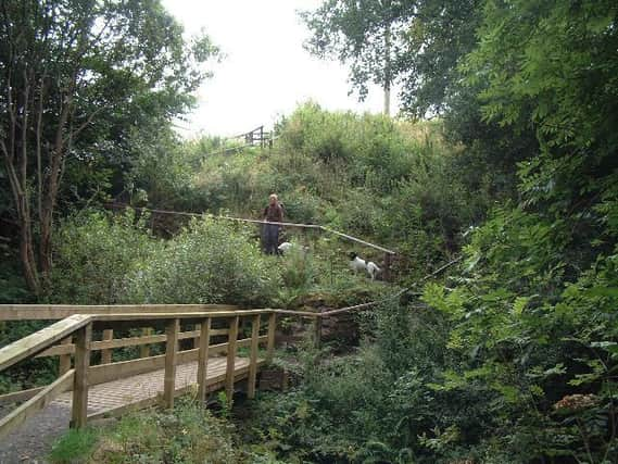
Ignoring a path that slants to the right by the back of houses, head north and pass through a lovely wooded strip to reach a sign, Formonthills Community Woodland. A slight descent leads to a stepped dip and a footbridge over the Conland Burn, after which the path gently rises by the wood on the left and a fence on the right beyond which are open fields. There were cattle there on our day so Jimbo was obliged to put the spaniels on the lead.
It is then into more open country and by now with the easily identified summit cone of East Lomond in sight. The path swings left then right to enter a new plantation. Once clear of the trees, the path which follows the line of an old stone dyke, steadily rises through open heathery moorland, heading for the less than attractive communication masts on Purin Hill and the East Lomond car park where I collected the leaflet, Accessing the Lomonds. The car park (with toilets) is approachable by Tarmac road from the east but surely that is too easy, even on a wintry day, for serious walkers.
Then follow the worn boot path on the steep grassy summit cone. The actual height of East Lomond is usually taken to be 424m as shown on the Ordnance Survey map, but this presumably refers to the trig point which is situated a short distance away to the south-east below the summit. The leaflet gives the hill a height of 434m. No matter, for both summit, with its informative plaque, and trig point are superb viewpoints. By the summit are remains of an Iron Age fort.
On a good day there is no reason why the walk should not be extended to West Lomond. On return it is easier to admire the southern aspect over the Forth and beyond, perhaps studying the viewfinder at the East Lomond car park.