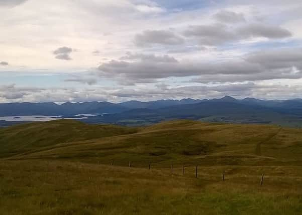
Walk of the week: Earl’s Seat


It is a Marilyn (hills of any height, but with a drop of at least 150m all round) and allied to its position at the western end of the Fells, that relative height and drop make it a contender for the best Lowland viewpoint. I last visited the area with Jimbo and John; a stroll by the Glazert Water to Clachan of Campsie, parallel to but well below the Fells. This time with Rhona, Earl’s Seat was the target.
The walk starts from Ballagan Farm by the A891, opposite Dunglass, a volcanic plug with a crag-and-tail feature and perhaps a good marker if descending on a misty day. This southern ascent overlooks Strath Blane, the Glazert Water and the Strathkelvin Railway Path, a pedestrian and cycle route on the track bed of the dismantled railway from Kirkintilloch to Strathblane. Beyond Strathblane, part of the old line is used by the West Highland Way. Higher up there are good views eastwards to the Forth and the Pentland hills, SE to Tinto and west to the Clyde and Arran. Being not too distant from Glasgow airport, expect to see planes. On the way up you may think that the views are impressive – indeed they are – but just wait until you reach the summit.
Advertisement
Hide AdAdvertisement
Hide AdMap Ordnance Survey map 64, Glasgow, Motherwell & Airdrie
Distance 9 miles
Height 600m
Terrain Zigzag track then undulating, wet at times grassy way
Start point Off-road parking spot, map ref 589791, south side of A891, ½ mile east of Ballagan Farm
Time 5 hours
Nearest villages Strathblane and Lennoxtown
Refreshment spot Aldessan Gallery and Coffee Shop, Clachan of Campsie
THE ROUTE
From an off-road parking spot, map ref 589791, on the south side of the A891, it is a ½ mile roadside walk west to Ballagan Farm and the start of a stony/grassy track. The zigzag track eases the initial 300m ascent, however, given the undulations on the out and back route, there is still another 300m to climb.
At the hint of a track junction, keep to the left to reach the track high point, then climb north to meet a grassy way and a line of fence posts which follow the county boundary all the way to the summit. Navigation could not be simpler.
Now coming into view to the east is 570m Meikle Bin, the highest of the Kilsyth Hills. According to an enthusiast I met a few years ago at its summit, it is one of the best viewpoints in Scotland. Earl’s Seat is even better.
On the undulating semi-moorland traverse over 508m Dumbreck (with trig point) and then Owsen Hill and Little Earl, the grassy way from time to time is indistinct and may be rather boggy – a traverse perhaps best done on a frosty but snow-less day.
Advertisement
Hide AdAdvertisement
Hide AdYet another fence comes in from the left, and both fences merge right to the nearby trig point of Earl’s Seat - and for the first time the magnificent views are revealed. The trig point is situated but a short distance from the northern spectacular basalt escarpment which, breached only by the Endrick Water and the B 818 at Fintry, extends some 14 miles eastwards over 511m Stronend and 485m Carleatheran.
Both peaks, plus Meikle Bin, are superb viewpoints, but given its location at the western end of the escarpment, there is no doubt that Earl’s Seat reigns supreme. On our admittedly crystal clear day, we had glorious views to the islands at the southern end of Loch Lomond and north to the Arrochar peaks and Ben Lomond. It may perhaps be at times a tedious traverse, but the effort is well rewarded.
On return take care to leave the grassy way at the same point, ie after passing by a gate. The immediate descent on a misty day may require care for the convex slope hides the top end of the mapped track. n