Walk of the week: A Beecraigs circuit


The park, which caters for a wide range of leisure and recreational activities, is open daily from 9am and closes at 10:30pm in summer and at dusk in winter – plenty of time then to explore its many attractions including the Balvormie play area and Beecraigs Loch.
In addition, further distant are a number of must-visit places such as Cockleroy, Cairnpapple Hill, the Knock and Witchcraig – all of historical interest and offering good viewpoints. Witchcraig is included in the following walk which, to suit my own purpose, starts from Linlithgow railway station and then heads south to the park. I am obliged to Derek, my companion that day for the following composite and well-researched nine-mile walk with a modest 300m climb.
Advertisement
Hide AdAdvertisement
Hide AdGiven the park’s multiplicity of criss-crossing paths, tracks and minor roads, traversing the area may be confusing at times. It is advisable to get a free map from the visitor centre, or download it in advance. Incidentally the park would be a good training ground for map and compass work.
Map Ordnance Survey map 65, Falkirk & Linlithgow
Distance 9 miles
Height 300m
Terrain Waymarked paths and minor roads
Start point Linlithgow railway station
Time 4 hours
Nearest town Linlithgow
Refreshment spot Beecraigs visitor centre refreshment spot
Start from Linlithgow station. Cross the Union canal and use the pavement by Manse Road to reach the southern end of the town and the speed de-restriction sign. Continue for 100 yards (take care, no pavement), turn right on the signed path, Dark Entry; a road from Manse Road to Preston Road that goes by a wooded area. At Preston Road, turn left, signposted, Beecraigs 1.2 miles, yet curiously with a Beecraigs Country Park welcome sign.
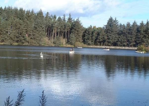
The newish path, initially separated by a dyke from the road, later veers away to pass another Beecraigs sign, notice board and map. The path continues curving southwards to meet a Tarmac road. Turn left for the visitor centre. Remember to get a map. Head downhill on a broad lane and turn left for Beecraigs Loch at the eastern side of the Park. Stocked with rainbow trout, the fly-fishing loch offers a charming clockwise stroll by embankment and dam, with time to admire swans and fishing boats alike – a must-photo spot.
At the west end of the loch, turn left on a minor road and pass by a sawmill on the left and a former quarry, now a climbing wall, on the right. Continue uphill. The road straightens by the edge of the wood to reach the SE boundary of the park. Turn right on the signed Guthrie’s Path which runs in a straight line for 1¼ miles by the wooded southern boundary. After crossing a Tarmac road, reach the 260m high point of Guthrie’s Path, Wairdlaw Hill, and a copse of ancient beech trees. Descend to a T-junction, the end of Guthrie’s Path, and turn left as signed Refuge Stone, Witchcraig Walk. Cross remnants of a dyke via a stile and so into Cathlaw Hill Woodland, from where the path climbs to Witchcraig.
The 280m summit offers excellent views over Lochcote Reservoir, Cockleroy and beyond the Forth, but alas not on our hazy day. On top is a fine shelter, a stone semi-enclosure; a wall comprised of samples of many rocks that reflect the geology of the hills around. Just behind, incorporated in a stone dyke, is the Refuge Stone. In the Middle Ages this stone marked the edge of the area of one Scots mile around Torphicen Preceptory of the Knights of St John, within which any debtors and criminals could claim sanctuary from their pursuers.
Return to the T-junction and follow the signs to the attractive Balvormie play area. Later turn left as signed and at a triple junction follow the middle path. From Balvormie head to the visitor centre and retrace steps to Linlithgow.