Walk of the week: The Great Trossachs Path


Jimbo and I opted to explore the 6½-mile section from the Glen Finglas Visitor Gateway, near Brig o’ Turk, to Callander.
Much of the Way is through lovely mixed woodland, with the path contouring the northern slopes high above Loch Venachar and the mostly hidden A821, then reaches Callander by the track bed of an old railway.
Advertisement
Hide AdAdvertisement
Hide AdIt is a secluded walk on an excellent path, such that the overall 200m ascent is scarcely noticed. Going west to east with the wind on our backs, the partly sheltered route was a good choice for our blustery day; a linear walk that alas involved taking two cars.
Map Ordnance Survey map 57, Stirling & The Trossachs
Distance 6½ miles
Height 200m
Terrain Superb path then Tarmac and old railway track bed
Start point Little Druim Wood car park, by the A821, just east of Brig o’ Turk
Time 3 hours
Nearest town Callander
Refreshment spot The Harbour Café, Venachar Lochside
Start from the Little Druim Wood car park on the south side of the A821, by the western end of Loch Venachar and just east of Brig o’ Turk. There is an informative notice board – welcome to the Great Trossachs Forest and Path.
Head east by pavement for a short distance, then carefully cross to the north side of the road and the start of a path – signed with two arrowheads, blue and brown. Climb the steep wooded lower slopes of Lendrick Hill, with the lovely well-graded grassy path of old easing the ascent with gentle zigzags. Rest if you will at a bench provided by Royal Mail employees in the woodland, part of the Royal Mail grove of trees.
The path eventually slants right, eastwards, to reach a T-junction and a new broad gravel path, the Trossachs Trail, indicated with a T sign. The bulk of the climb is over. The two arrows point left, uphill, however time for a change in direction – eastwards. The path rises slightly higher on its undulating and twisting way well above the loch and the periodic trail signs are scarcely needed. Ignore a path that descends to the right and continue east.
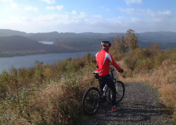
There are some new metal gates, with horse-rider/mountain-biker friendly latches. The Great Trossachs Path is also designed for mountain bikes and interestingly the sole person we met was a cheerful mountain biker, Chris Ryan, who preferred the path to the busy A821.
Now for the gentle descent. Pass by water treatment works on the right and briefly follow the broader track used for works access. The track crosses Milton Glen Burn by a wide planked bridge then cuts down right to the road. However, continue on the signed path, though taking care at a junction to keep going eastwards.
Reach a new triple wooden signpost – back the way Brig o’ Turk; to the right Invertrossachs; to the left Callander and Samson’s Stone. A few yards later there is a sign to the Stone. Clearly seen from the path, this is an erratic deposited on Bochastle Hill by a retreating glacier in the last Ice Age. Descend to the Woodland Trust Bochastle car park.
Advertisement
Hide AdAdvertisement
Hide AdCross the A821 with care and turn left to reach a parking area and a triple blue sign; Brig o’ Turk 6 miles; Route 7 of the National Cycle Network to Strathyre; and route 7 to Callander 1.25 miles. Turn left on the Tarmac track bed of the old Caledonian – Callander to Oban – railway line which was due to be closed in November 1965 as part of the Beeching cuts, but a rock fall in Glen Ogle in the September accelerated that decision. The track bed on an embankment curves round the flood plain of the River Leny then crosses the river by a metal footbridge that has replaced the old railway bridge, and so to the Meadows car park in Callander.