Walk of the week: Beinn a’Bheithir


Bheithir can mean thunderbolt or electric storm, indeed Cailleach Bheithir is the Celtic goddess of wind and storm, but with a contradictory character….at times a beautiful maiden, at times a destructive demon.
Unlike other mountains subsequently promoted to double-Munro status, Beinn a’Bheithir has had two Munros from the start, 1,024m /3,360ft Sgorr Dhearg and 1,001m/3,284ft Sgorr Dhonuill. Being a mile apart and separated by a 757m bealach, that dual status is justified. Sgorr Dhearg has one subsidiary Top, 947m Sgorr Bhan, connected by a beautiful curving ridge, steep sided on both sides; a corniced arc in winter. With snow or ice around, have an ice axe to hand and crampons to foot.
Advertisement
Hide AdAdvertisement
Hide AdApart from the small southern watershed between Glen Duror and Gleann an Fhiodh (glens that offer a superb low-level walk from Duror to Ballachulish) Beinn a’Bheithir is surrounded by water and there are many approaches to what is a separate mountain... from the north into Glenachulish Forest and Gleann a’Chaolais, from the west into Glen Duror, or from Ballachulish via Gleann an Fhiodh. The latter, climbing a ridge only suitable for those with minor scrambling experience, was the approach John and I took on our day of early foggy dew. However, given the forecast of a 90 per cent chance of cloud free summits, we were happy to head uphill and the low cloud mostly cleared to give an atmospheric day.
Map Ordnance Surveymap 41, Ben Nevis, Fort William & Glen Coe
Distance 8 miles
Height 1,300m
Terrain Grassy slopes to ridge where scrambling is required
Start point Ballachulish primary school, map ref 080578
Time 6 hours
Nearest village Ballachulish
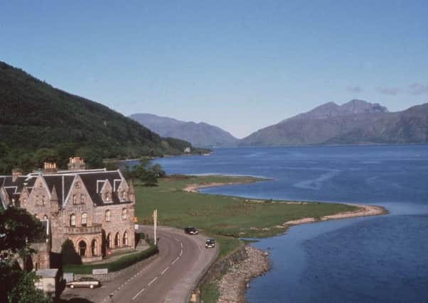
Refreshment spot The Ballachulish Hotel, South Ballachulish, pictured
From Ballachulish primary school, map ref 080578, follow the track south, high on the west side of the River Laroch, to enter Gleann an Fhiodh. Stay with the track for half-a-mile then strike up for the NE ridge to Sgorr Bhan. More of a grassy/heathery shoulder at first, the ridge gradually becomes more defined and a developing zigzag path eases the climb. Higher up, as the ridge narrows, hand to rock is required in places. Keep the route for a dry day. The one awkward short stretch can be avoided on the left.
Then it is easy walking to Sgorr Bhan. Continue SW, dropping less than 50m, then west to the small bare summit of Sgorr Dhearg, red peak. Little is now left of the trig point covered by a cairn, just a few feet away from the sharp drop to the NE.
Descend SW (not north!) on a quartzite then grassy path to the 757m bealach and the remnants of the once fence and stile. Sgorr Dhonuill, Donald’s peak, is craggier than Sgorr Dhearg, and on a poor day may seem daunting. The short climb west from the bealach is straightforward at first, with a good path zigzagging on the lower slopes. However, on reaching the sharp summit area, care is needed in traversing rough boulders on the south side of the narrow ridge or in following an exposed path on the northern side high above Gleann a’Chaolais. Care is needed on descent.
Once back at the bealach, follow the line of fence posts and descend southwards on steep grassy slopes.
Lower down, gradually head SE (left) and follow the edge of the now-felled forest to its north-east extremity, map ref 057548. Then head south to reach the path at the eastern end of the forest. Passing a cairn marking a right of way south to Glen Creran, the Gleann an Fhiodh path can be vague at times over grassy stretches, but it is a most pleasant 3-mile semi-wooded and gentle descent back to the start point.