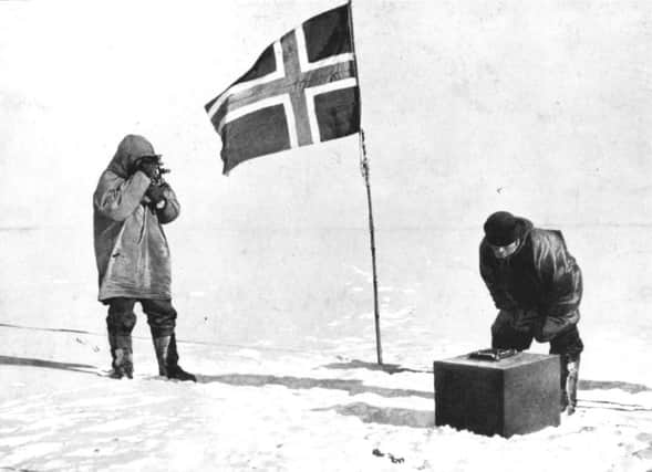
Roger Cox: Saluting the explorers who mapped the world


Curious to know what a far-flung, tricky-to-visit place looks like? No problem. In a few clicks you can be hovering above Kim Il-sung’s mausoleum in Pyongyang or standing in front of the Potala Palace in Lhasa. No fiddly paperwork or over-curious state-sponsored tour guides required. True, there are still plenty of places that remain gratifyingly hidden from Google’s prying eyes (zooming in on the Amazon rainforest is a pretty pointless exercise unless you’re a massive fan of the colour green) but these days, if you want to find out what a particular part of the Earth’s surface looks like, you should be able to locate it in a matter of seconds and have a right good gander.
All of which makes a beautiful new book published by the Folio Society seem both quaintly old-fashioned and at the same time a very timely reminder that a) we didn’t always have it this easy and b) no matter how good the boffins of Silicon Valley get at conjuring up virtual reality, when it comes to exploring the planet it’s unlikely there will ever be a decent e-substitute for the real thing.
Advertisement
Hide AdAdvertisement
Hide AdTo read Into The Unknown: Tales From The Great Explorers is to travel back in time to an era when there were still huge blank spaces on the map, and when the only way to figure out what was there was to organise an expedition, order up industrial quantities of pemmican and go and have a look-see. Drawing on the archives of the Royal Geographical Society, the book includes John Hanning Speke’s account of his discovery of the source of the Nile, delivered in 1863, Fridtjof Nansen’s lecture on his “impossible” crossing of Greenland, dating from 1889, and Roald Amundsen’s tale of his successful transit of the North-West Passage, presented in 1907. There’s not exactly a desperate shortage of literature on some of these expeditions, as a visit to your local bookshop should amply demonstrate, but what makes the texts in Into The Unknown so compelling is that they represent the explorers’ first-hand accounts of their experiences, as delivered in a live setting to an audience of their peers. These men may think they have made new discoveries, but the onus is still on them to convince the learned and extravagantly moustachioed members of the RGS of the accuracy and significance of their findings.
This is particularly true in the case of Speke. When he delivered his lecture on The Nile And Its Sources he was still in the midst of an acrimonious dispute with his former expedition partner Richard Burton about where the Nile began, so rather than a straight report his lecture reads more like a legal argument, right down to the modest, keen-to-sound-reasonable preamble: “I shall blend native information with my own experiences, and in doing so shall hope to teach others what I know, and, beyond that, what I believe myself.”
To read these lectures, then, isn’t simply to go back over old ground – it’s to experience the whole crazy jigsaw of our planet being painstakingly assembled, piece by piece, for the very first time.
A good illustration of how rapidly Speke, Nansen, Amundsen and their near contemporaries were advancing our knowledge in the late 19th and early 20th centuries is provided by another excellent new book, Map: Exploring the World, published by Phaidon. Taking in everything from a 2,500 year-old Babylonian clay tablet depicting a very Babylon-centric map of the known universe, to an infographic mapping global Twitter activity, the book takes a broad and enlightened view of what a map can be, and what it can do. What it shows most strikingly, however, is that it’s only very recently – in the grand scheme of human history, at least – that we’ve finally been able to figure out where everything is with any degree of accuracy. That Babylonian clay tablet wouldn’t have been much use for navigating around downtown Babylon, let alone anywhere further afield, and, over the subsequent 2,300 years or so, humanity’s map-making skills didn’t get a whole lot better. A ninth century map of the River Nile made in Baghdad looks like a child’s drawing; a 16th century attempt at mapping the same river taken from an Ottoman atlas is similarly inept, although with more in the way of gold leaf. Sure, if we’d waited long enough Google Maps would eventually have told us that the Nile didn’t in fact issue from the mythical “Mountains of the Moon”, as previously thought. But Speke got there first, and in old-school exploration terms, that’s really all that counts.